
Get the book!

Prefer to listen?
🎉 Help keep Sketchplanations ad-free 🎉 Keep this ad-free 🎉 Help keep Sketchplanations ad-free by supporting me
Geography: ideas and frameworks explained
A collection of ideas, frameworks and techniques related to Geography, explained clearly so they are easy to understand and share. Browse practical concepts, principles and tips, with visual examples to make them memorable.
 The Volcanic Explosivity Index (VEI): Comparing Eruptions
 Dune Types: Transverse, Linear, Barchan, Star Dunes
 Cream Tea: Cream First or Jam First?
 Latitude and Longitude: How to Remember Which is Which
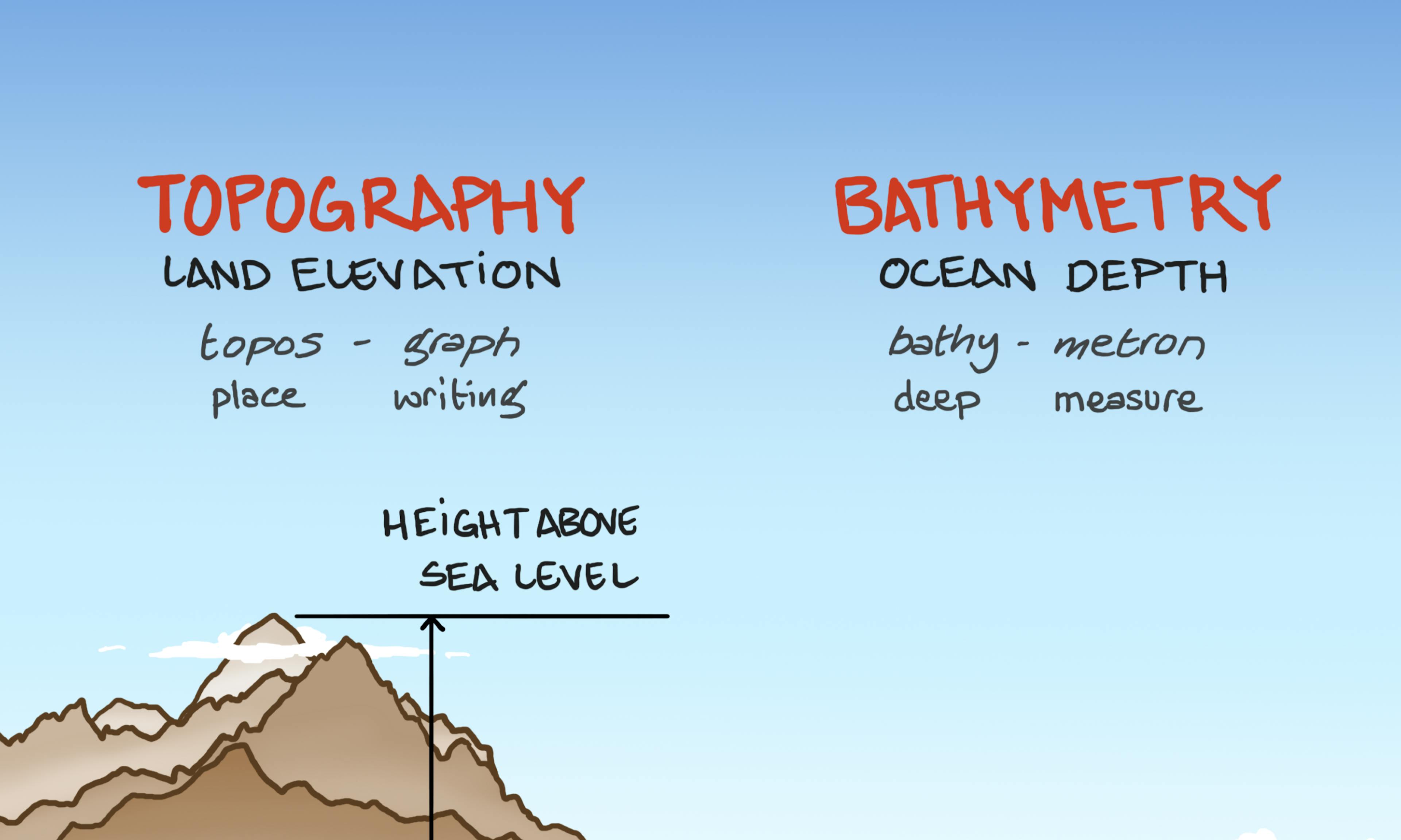 Topography and Bathymetry
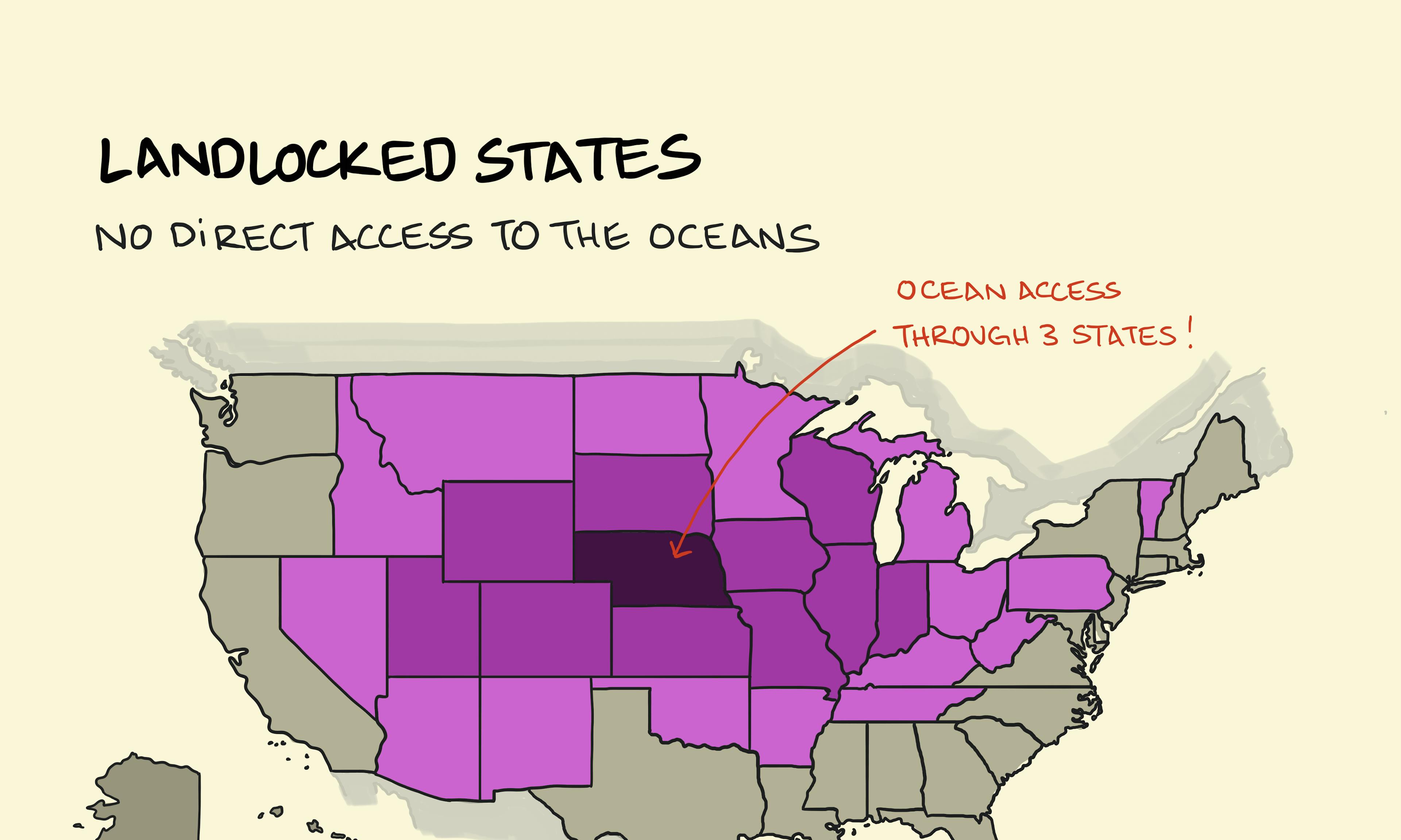 Landlocked States
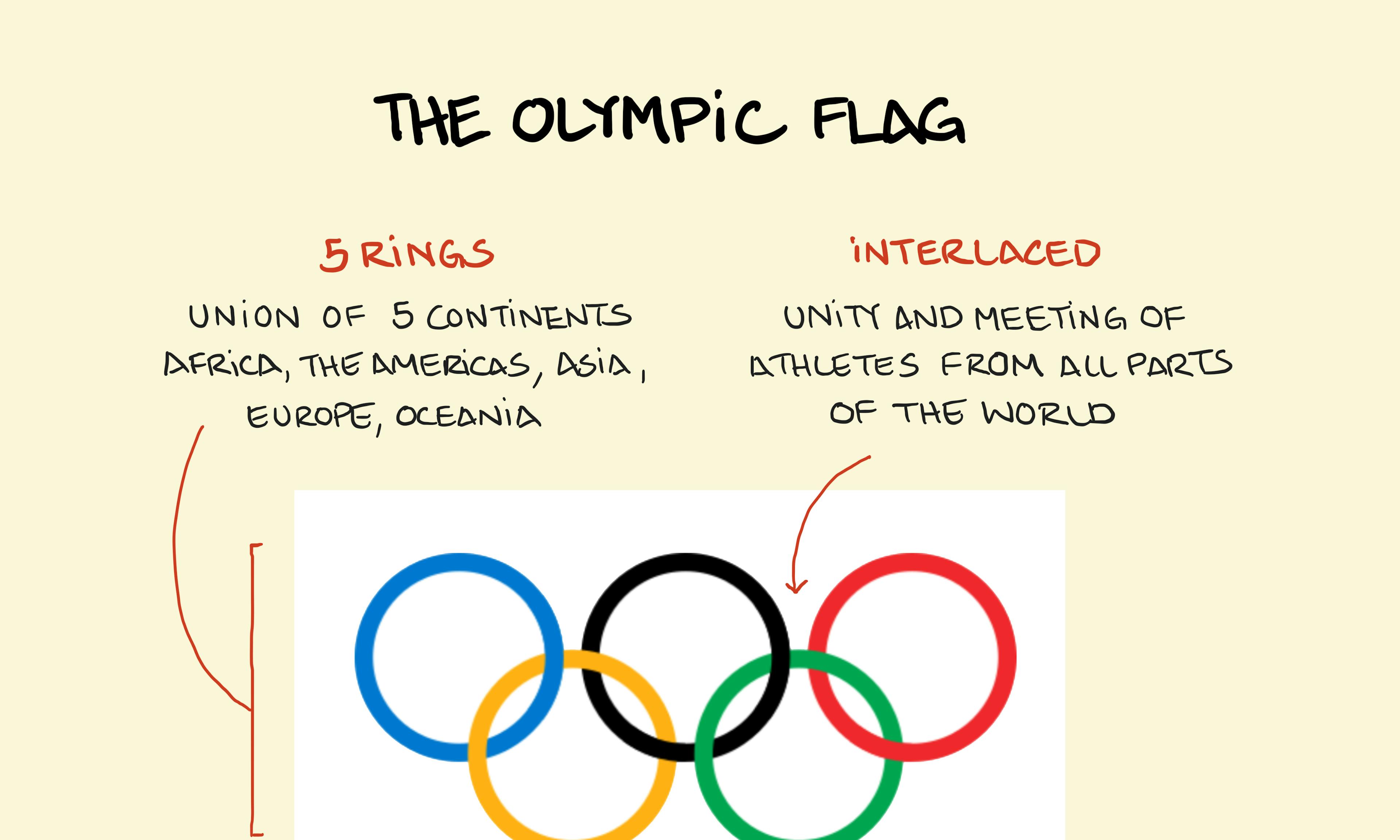 The Olympic Flag
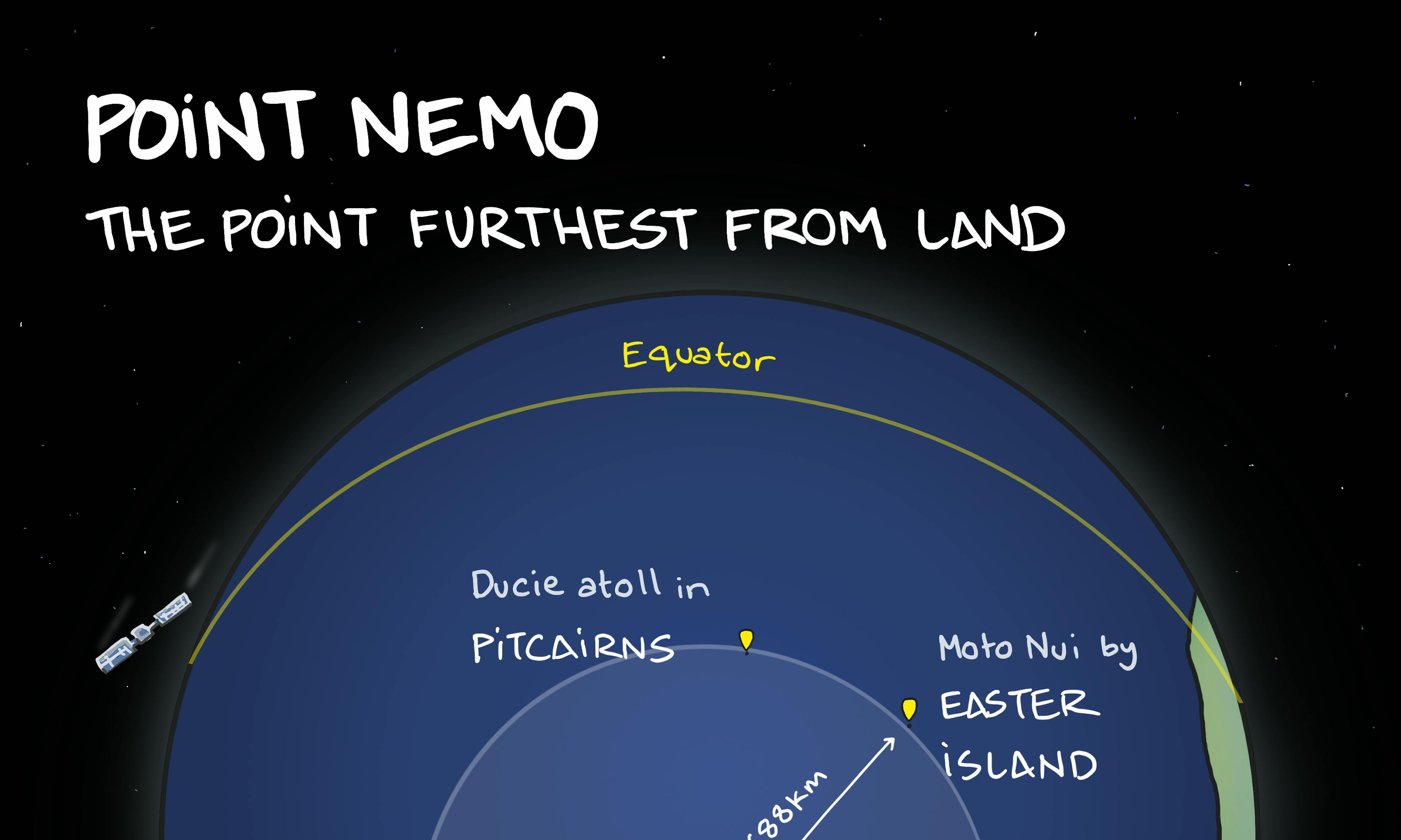 Point Nemo: The Most Remote Place on Earth and the Spacecraft Graveyard
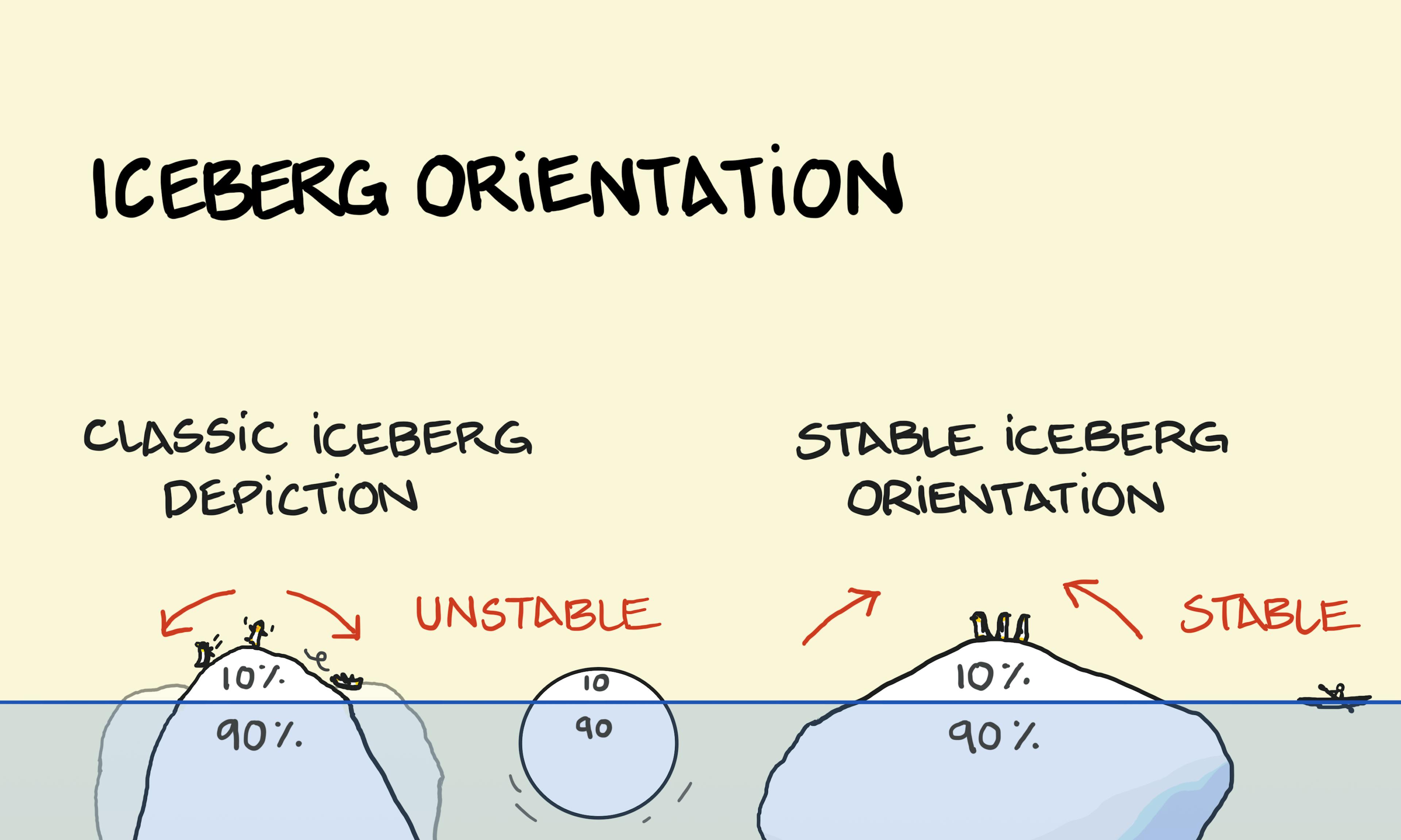 Iceberg orientation
 Red volcano, grey volcano
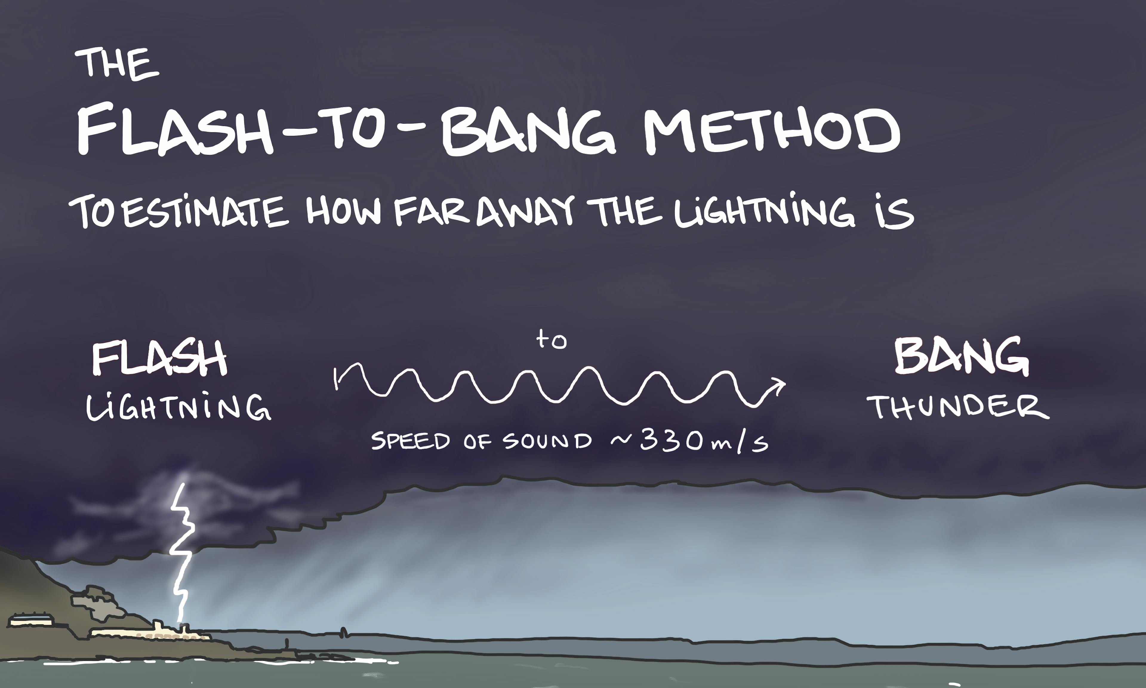 Flash-to-bang method
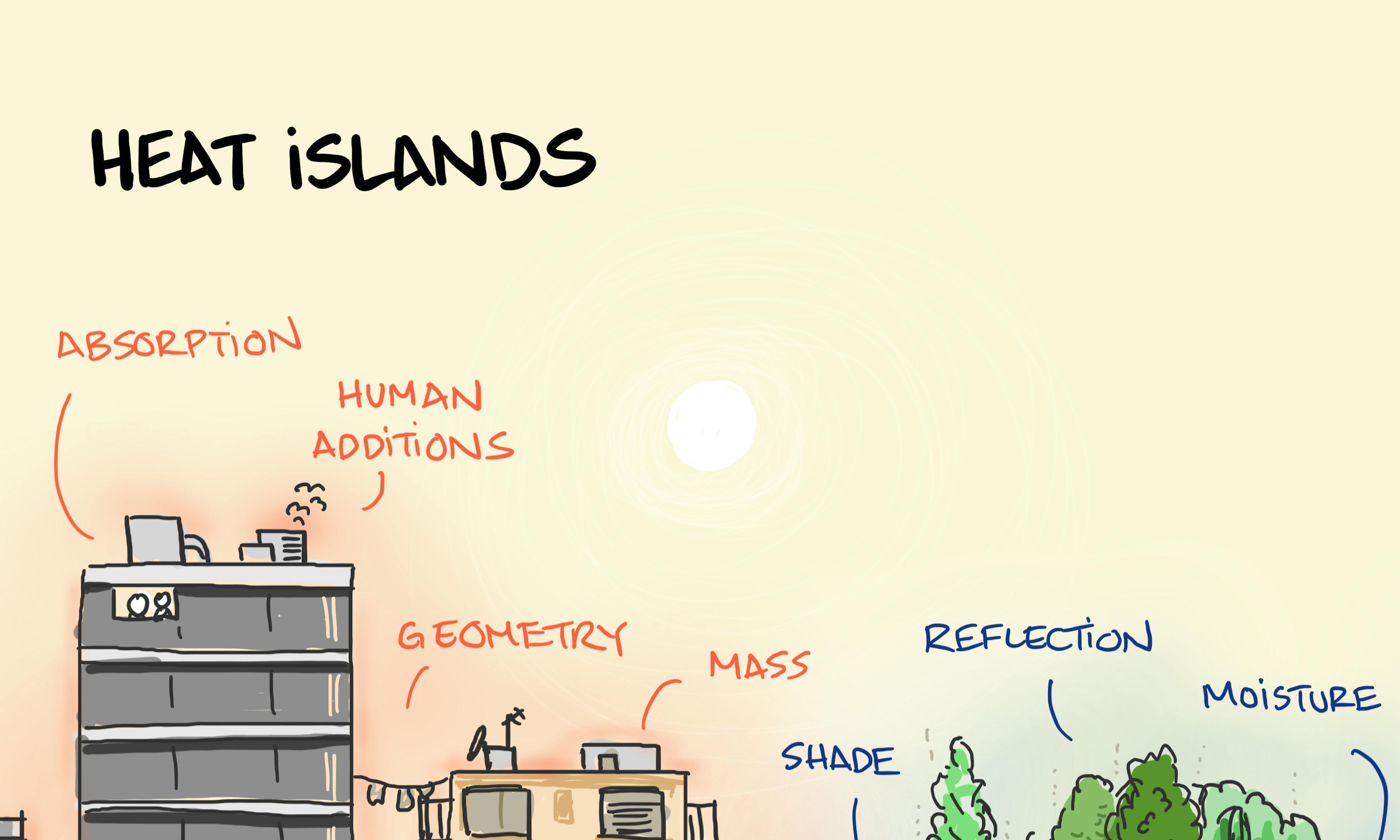 Heat islands
 Settlement patterns
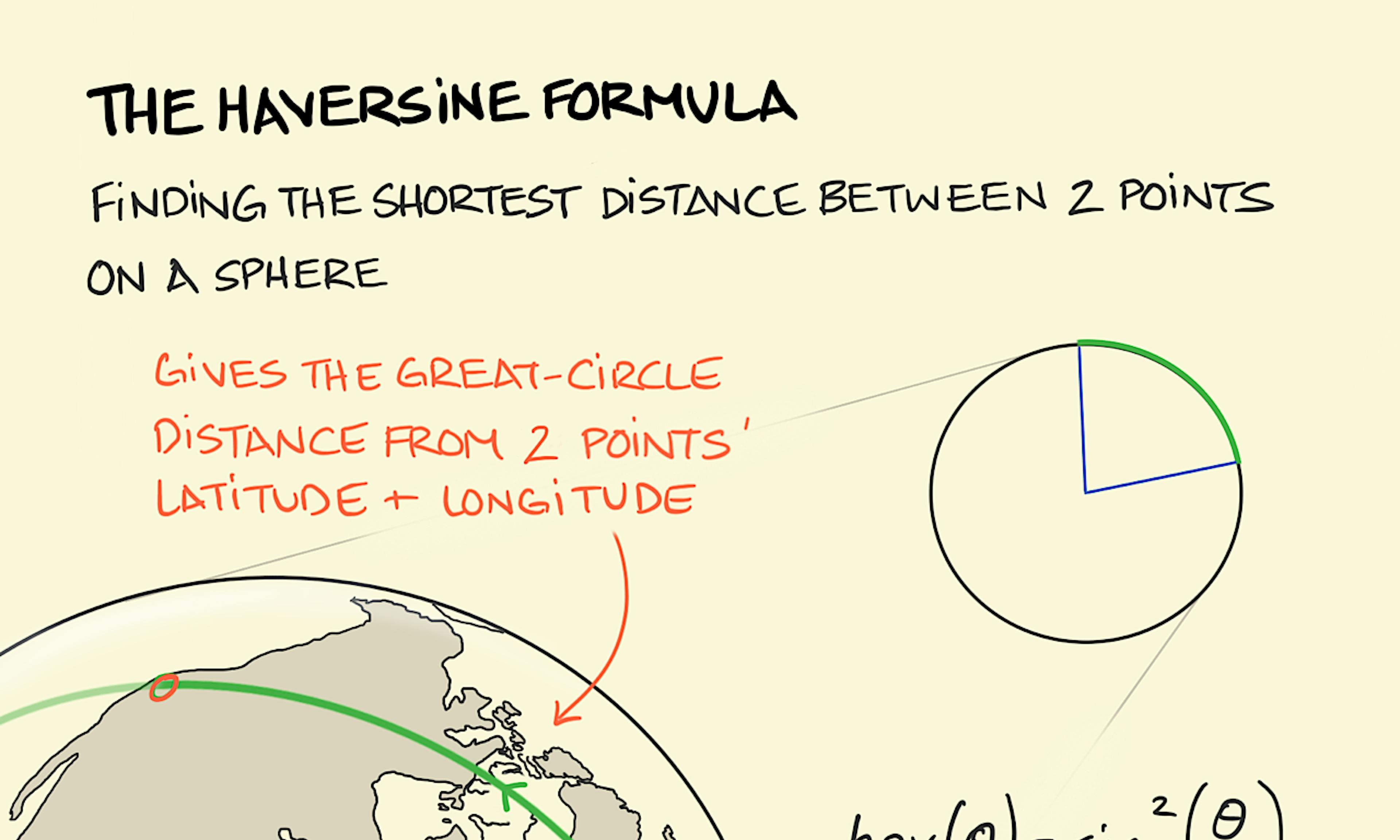 The haversine formula
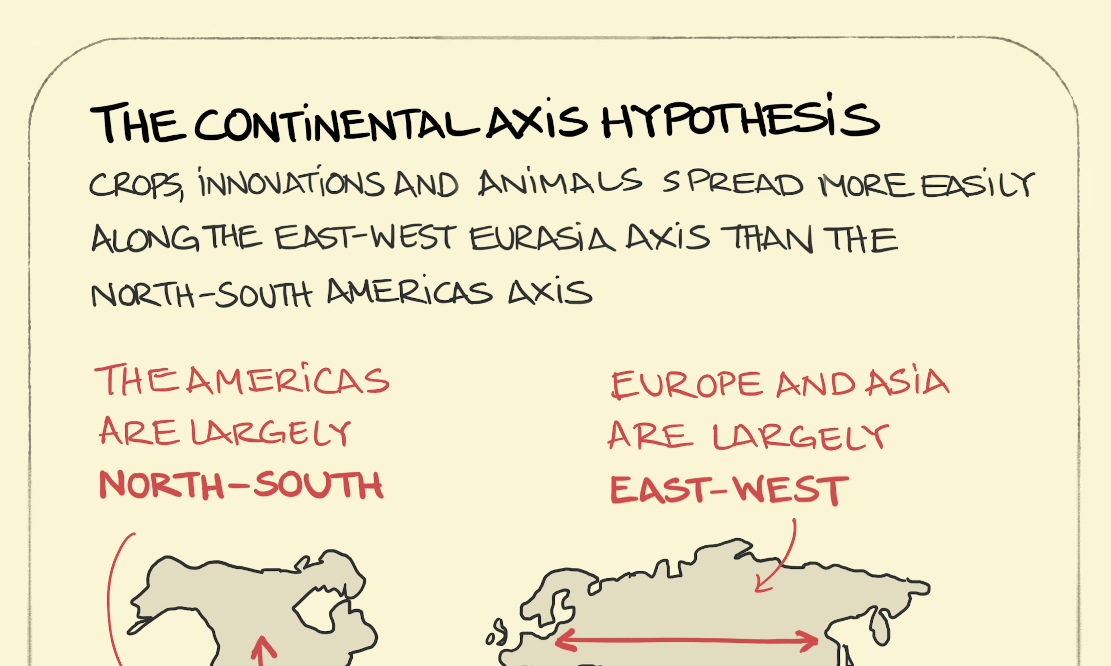 The continental axis hypothesis
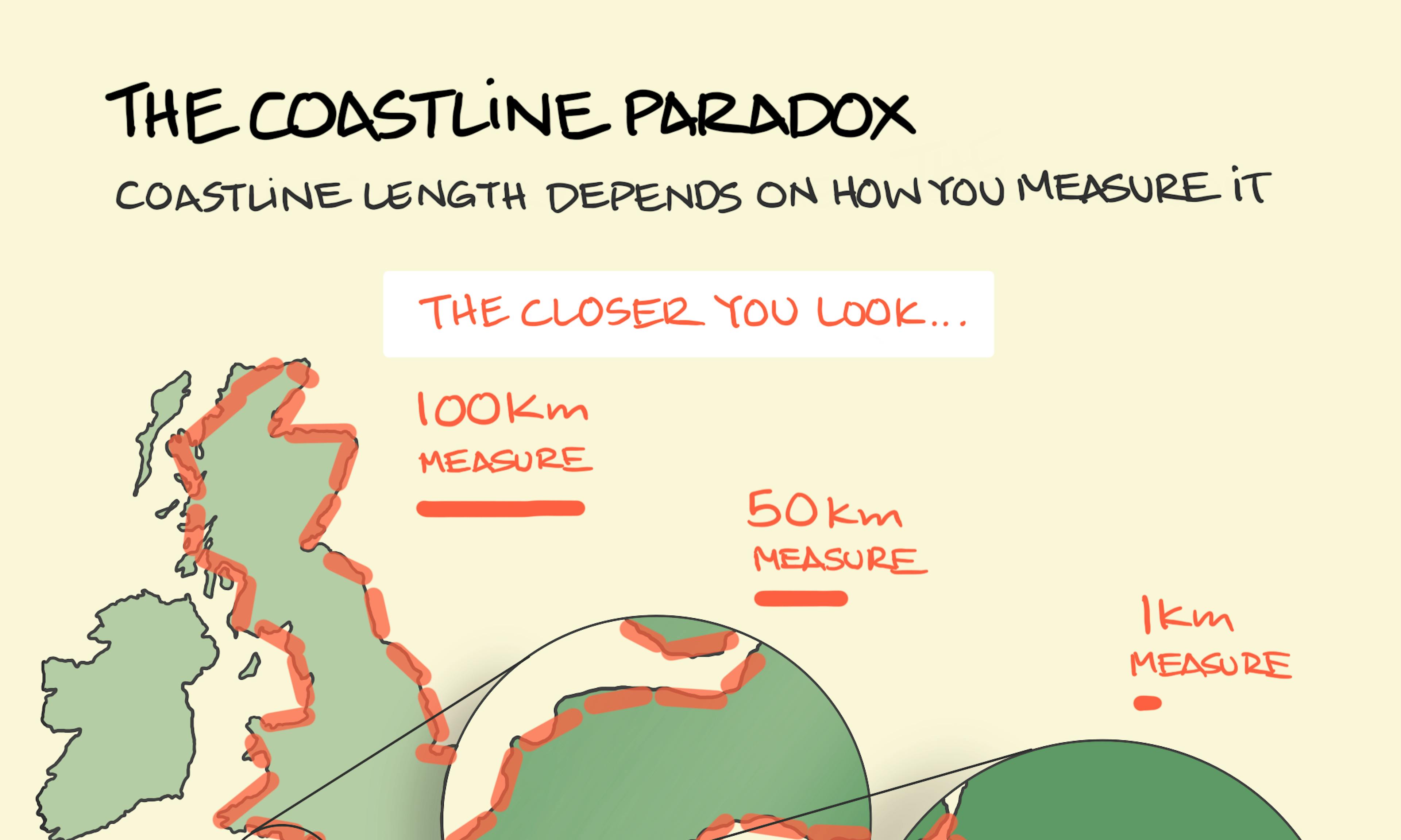 The Coastline Paradox
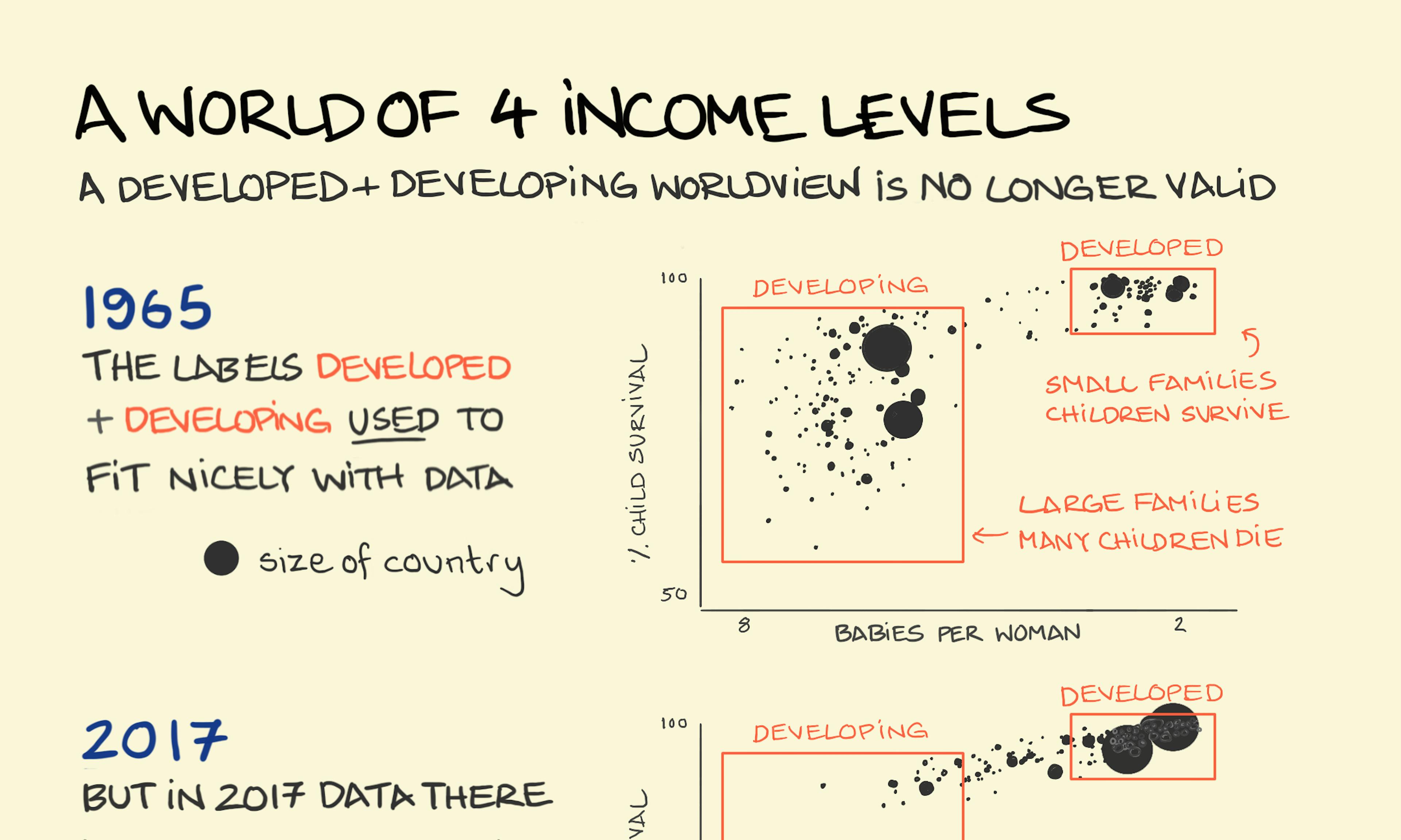 A world of 4 income levels
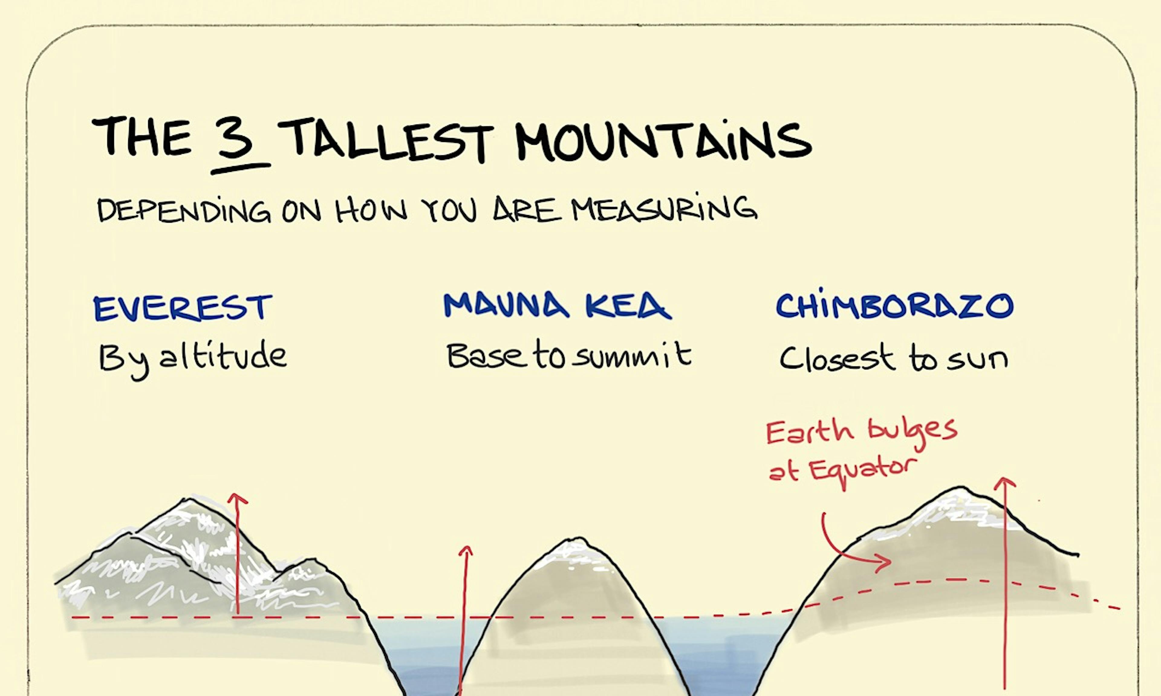 The 3 tallest mountains
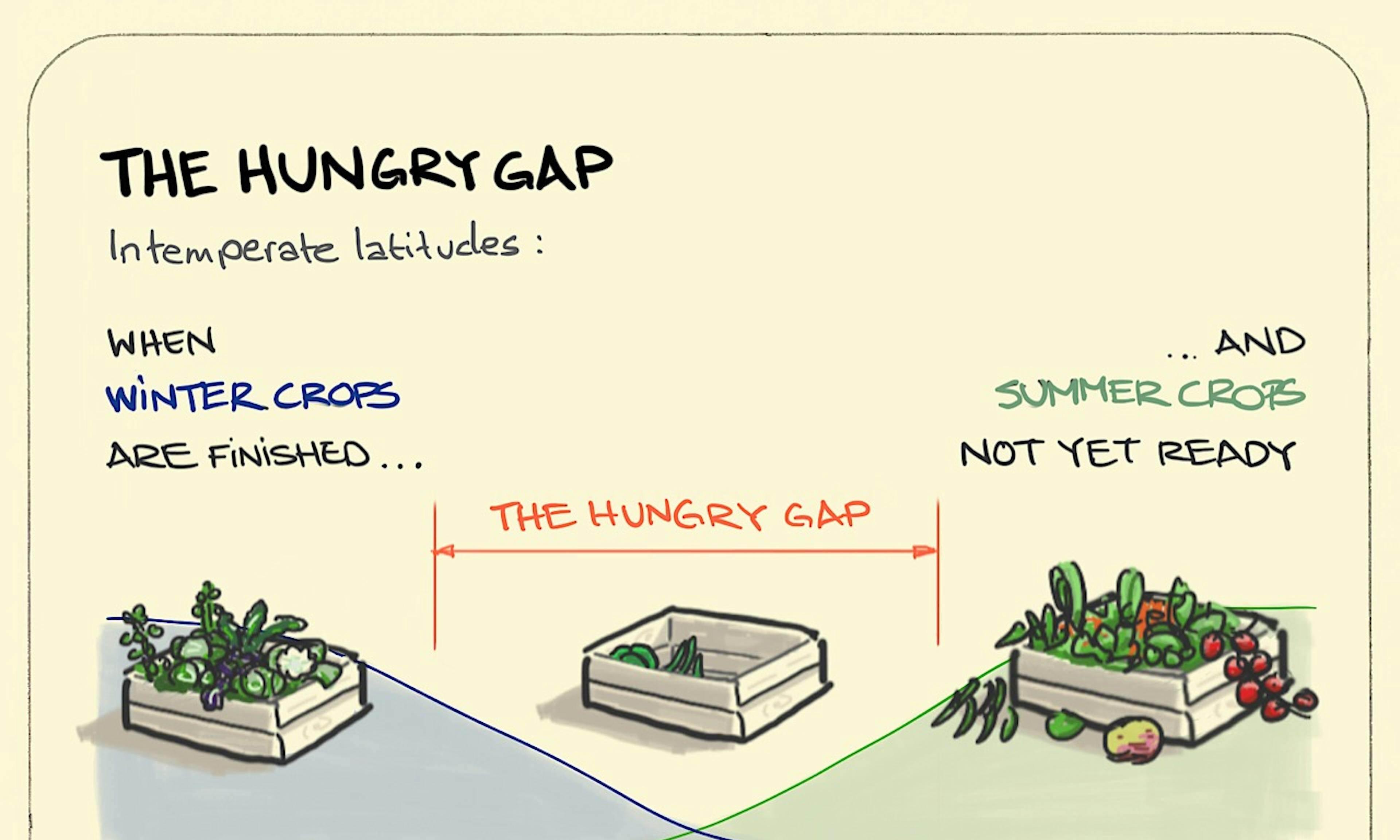 The Hungry Gap
 The Mercator projection
 Seasons
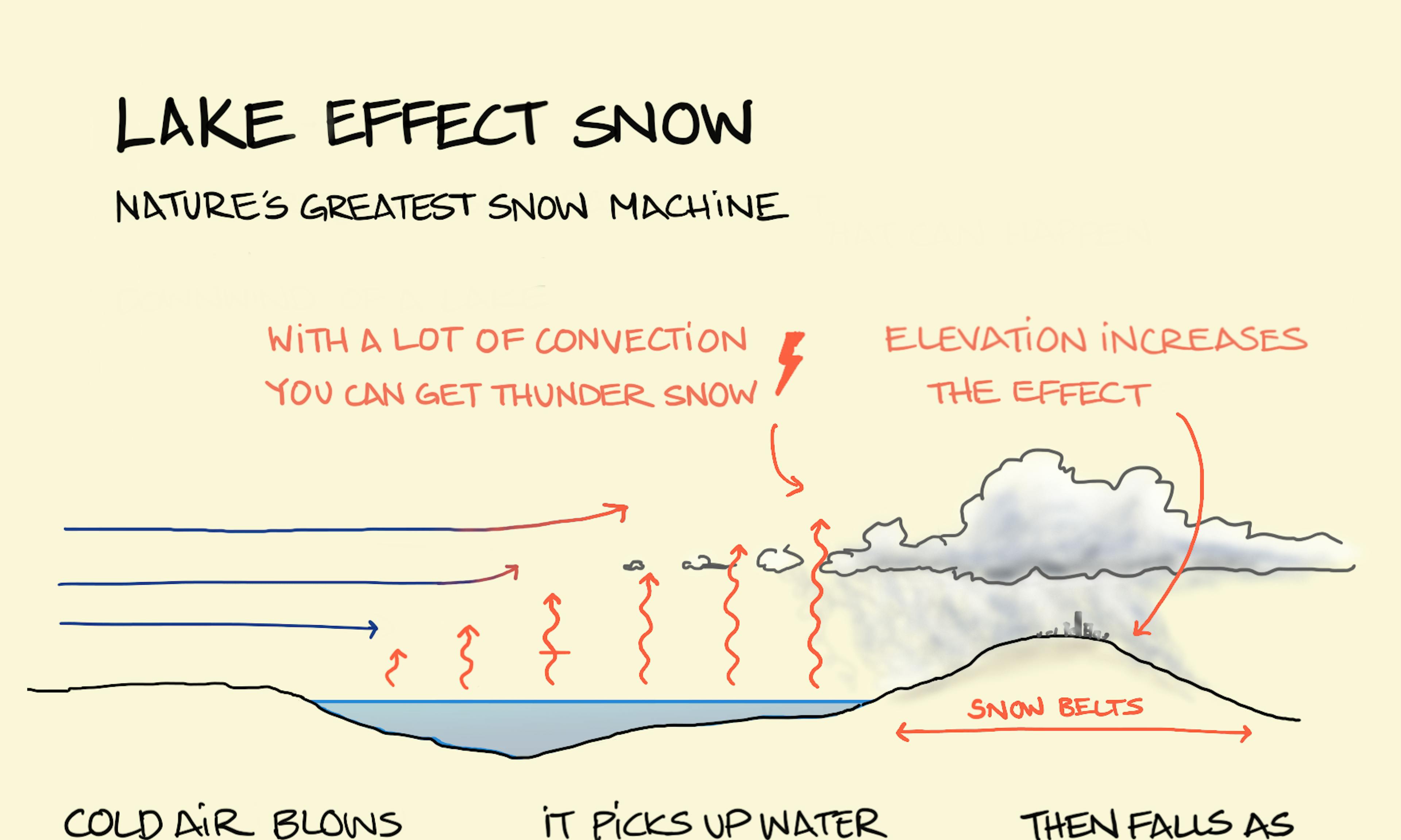 Lake-effect snow
 Double-landlocked countries
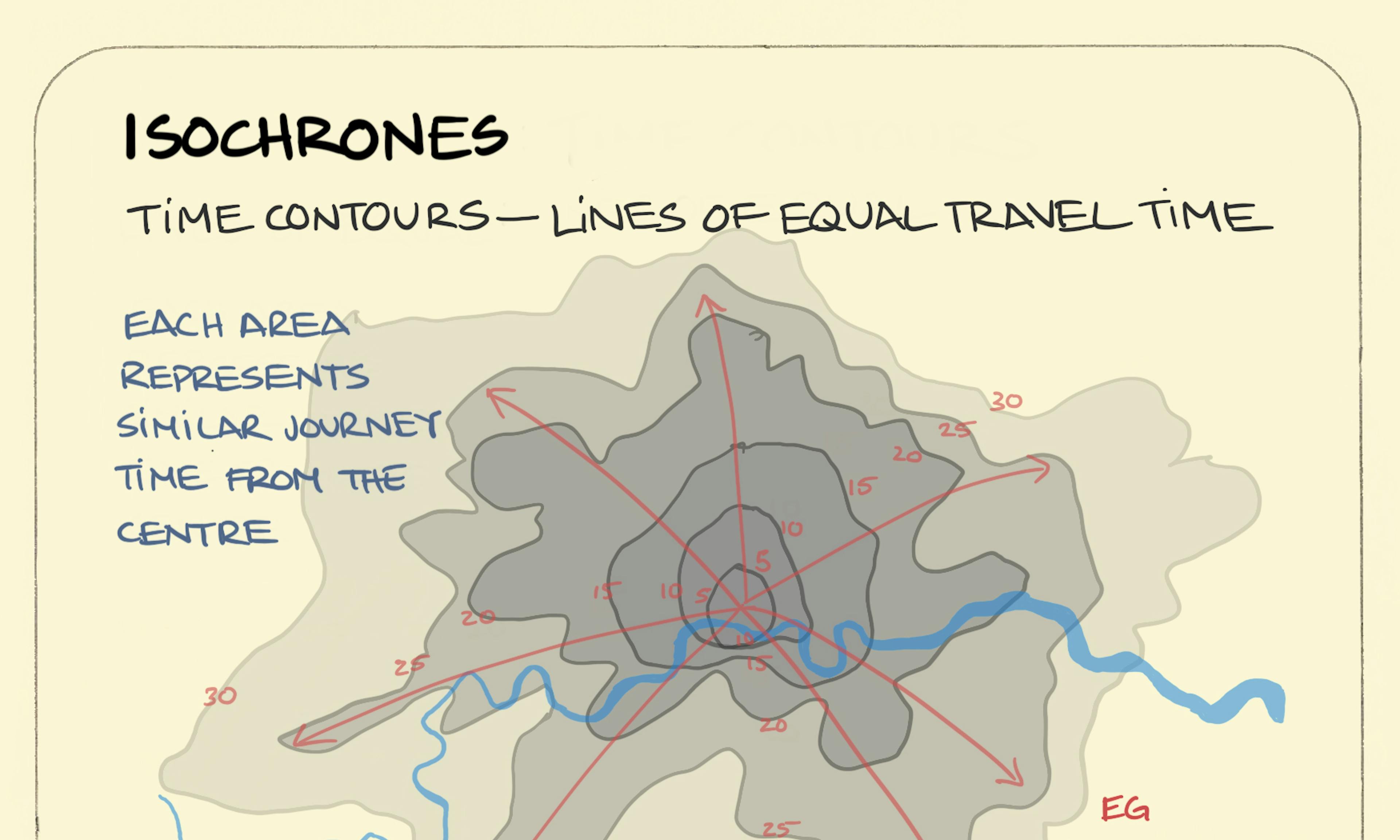 Isochrones
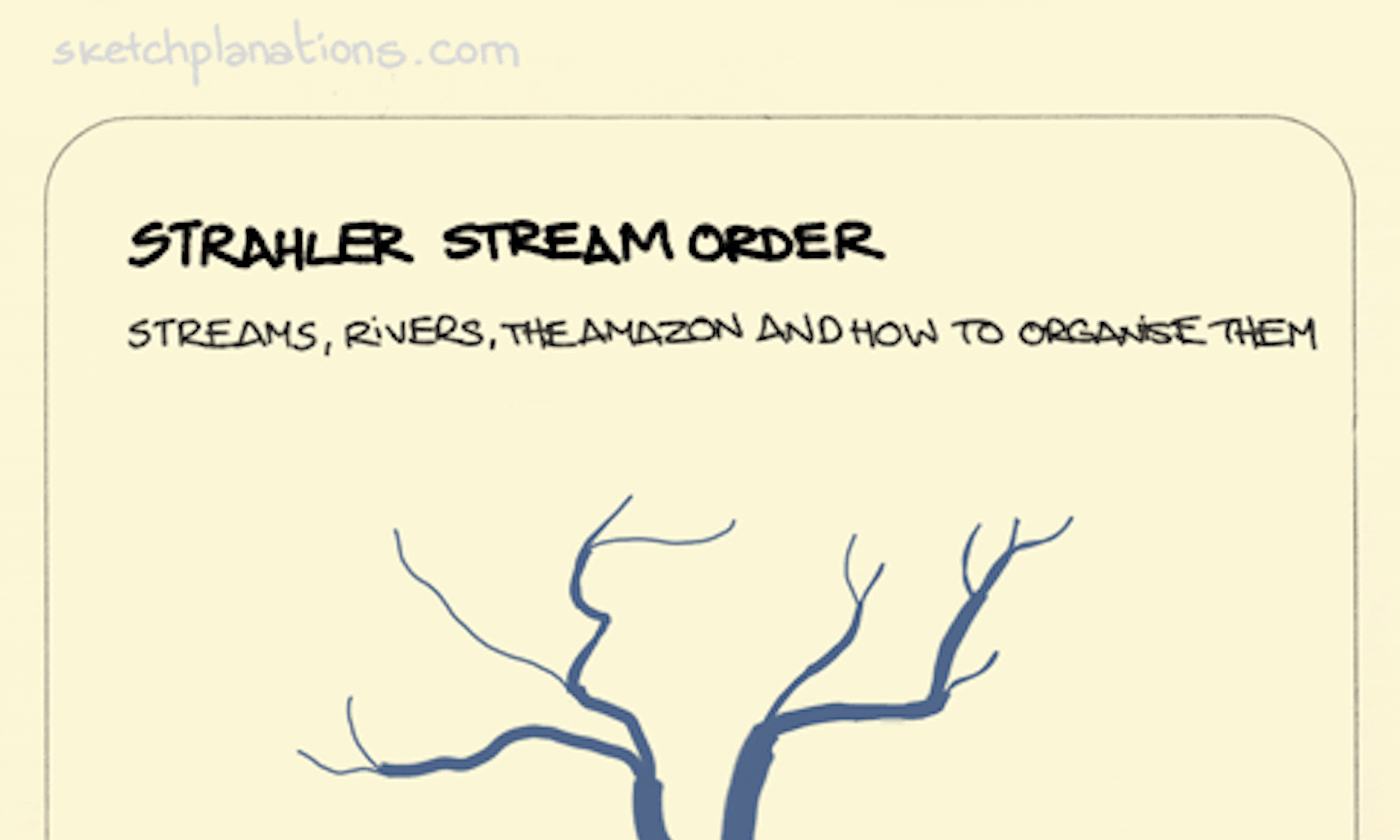 Strahler stream order: Streams, rivers, the Amazon and how to organise them.
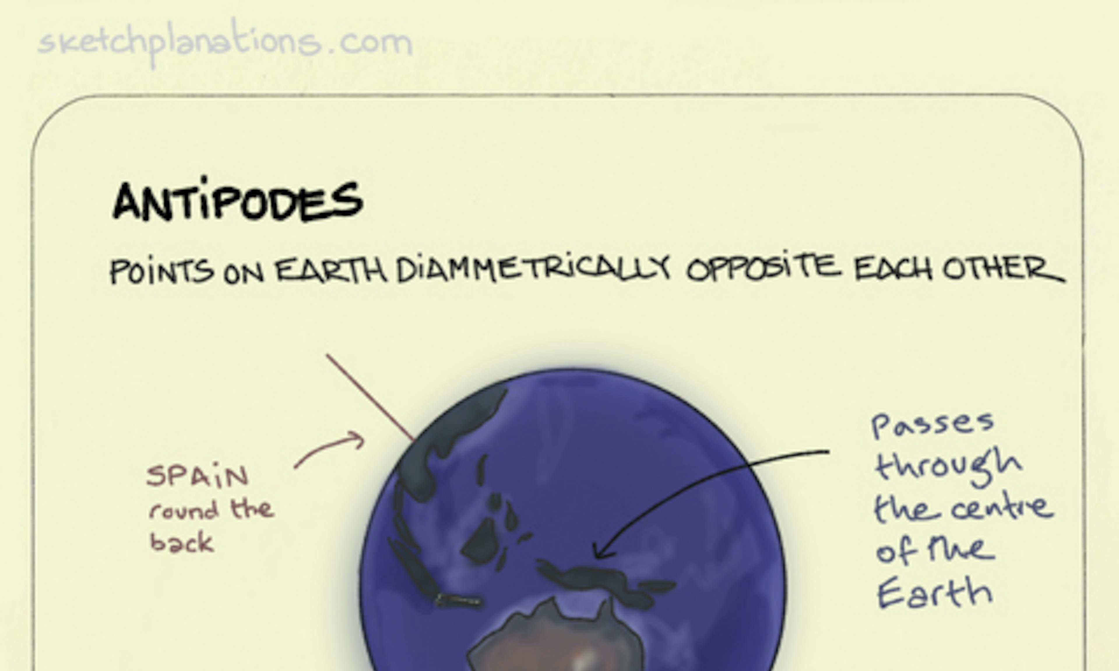 Antipodes
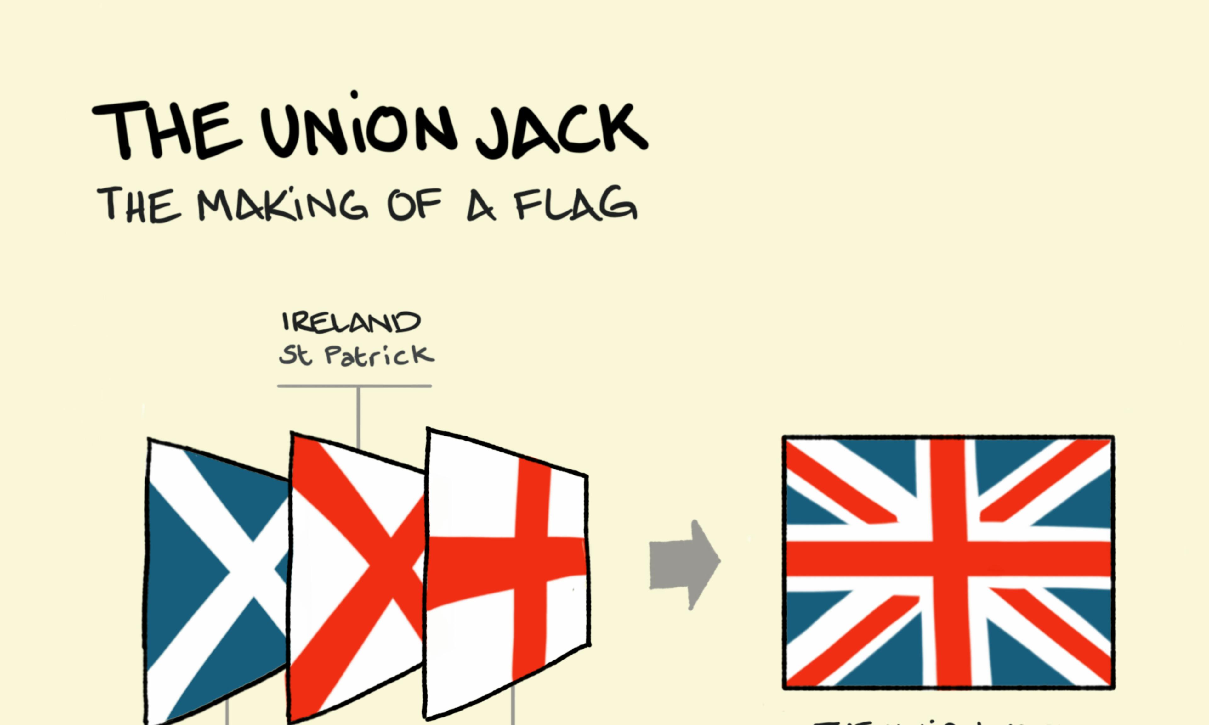 The Union Jack
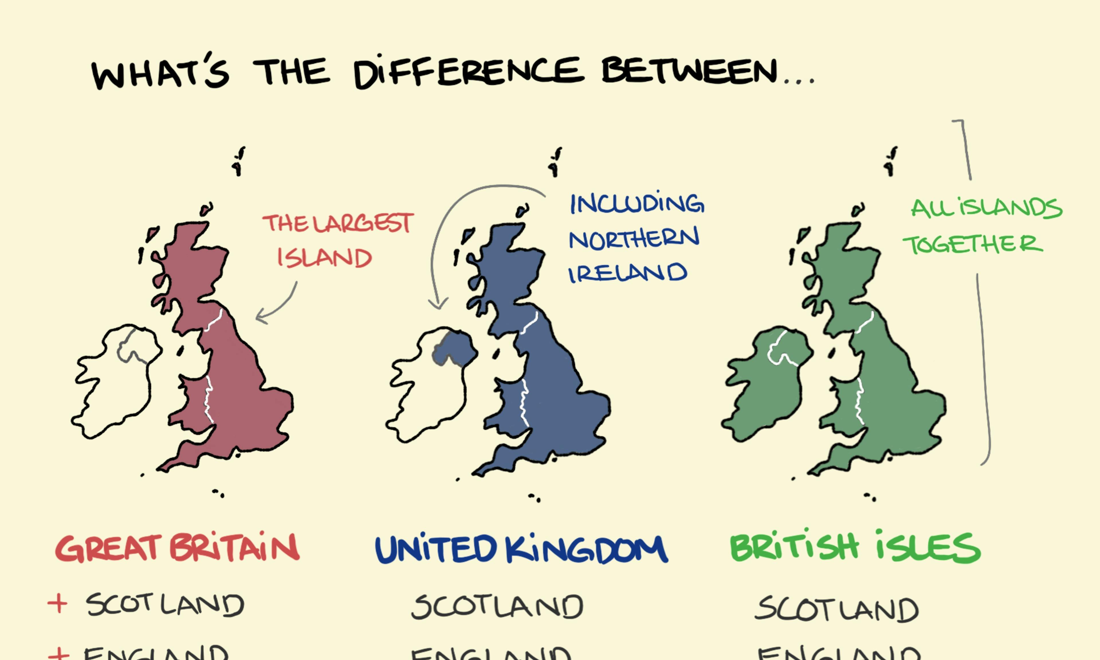 Great Britain and the United Kingdom: What’s the difference?
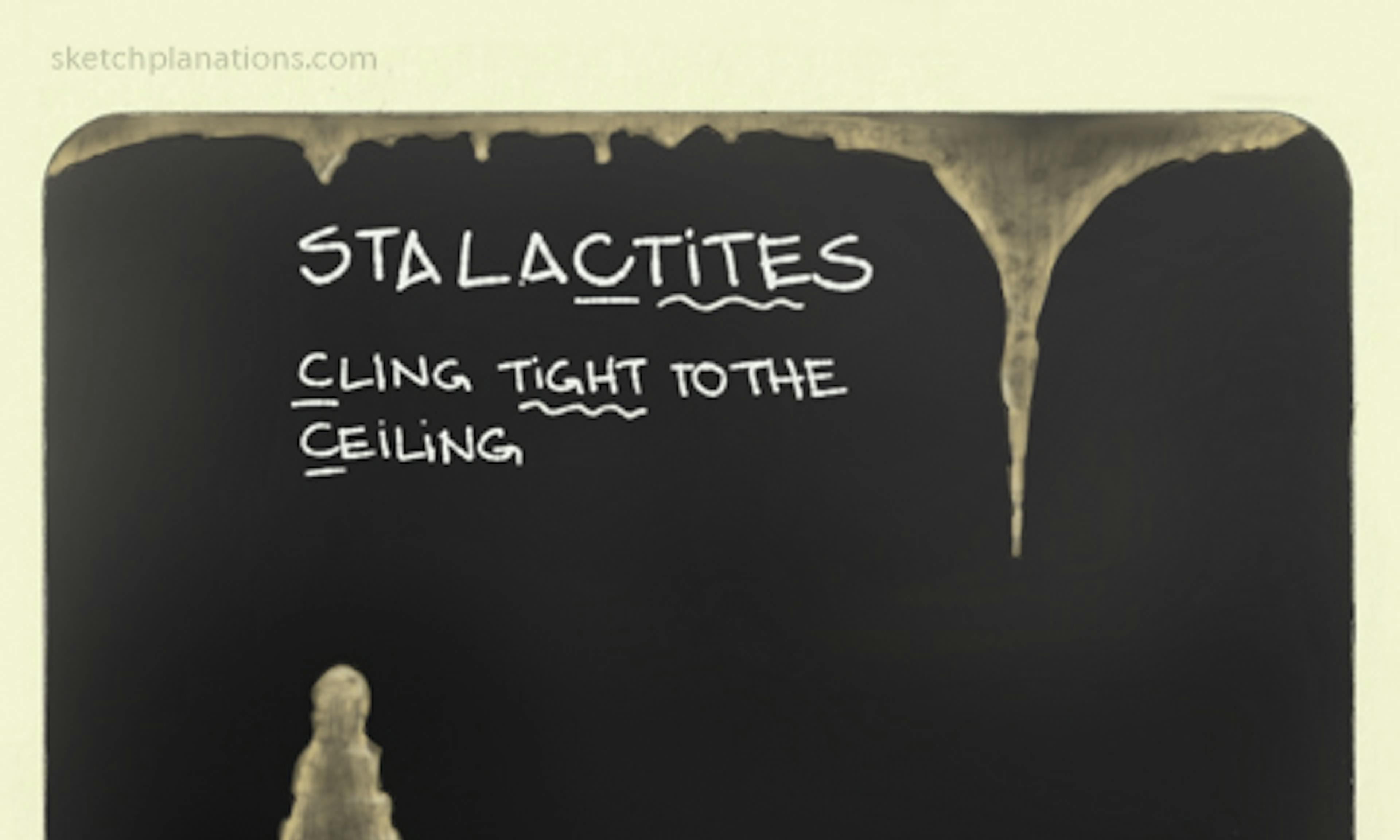 Stalactites, Stalagmites
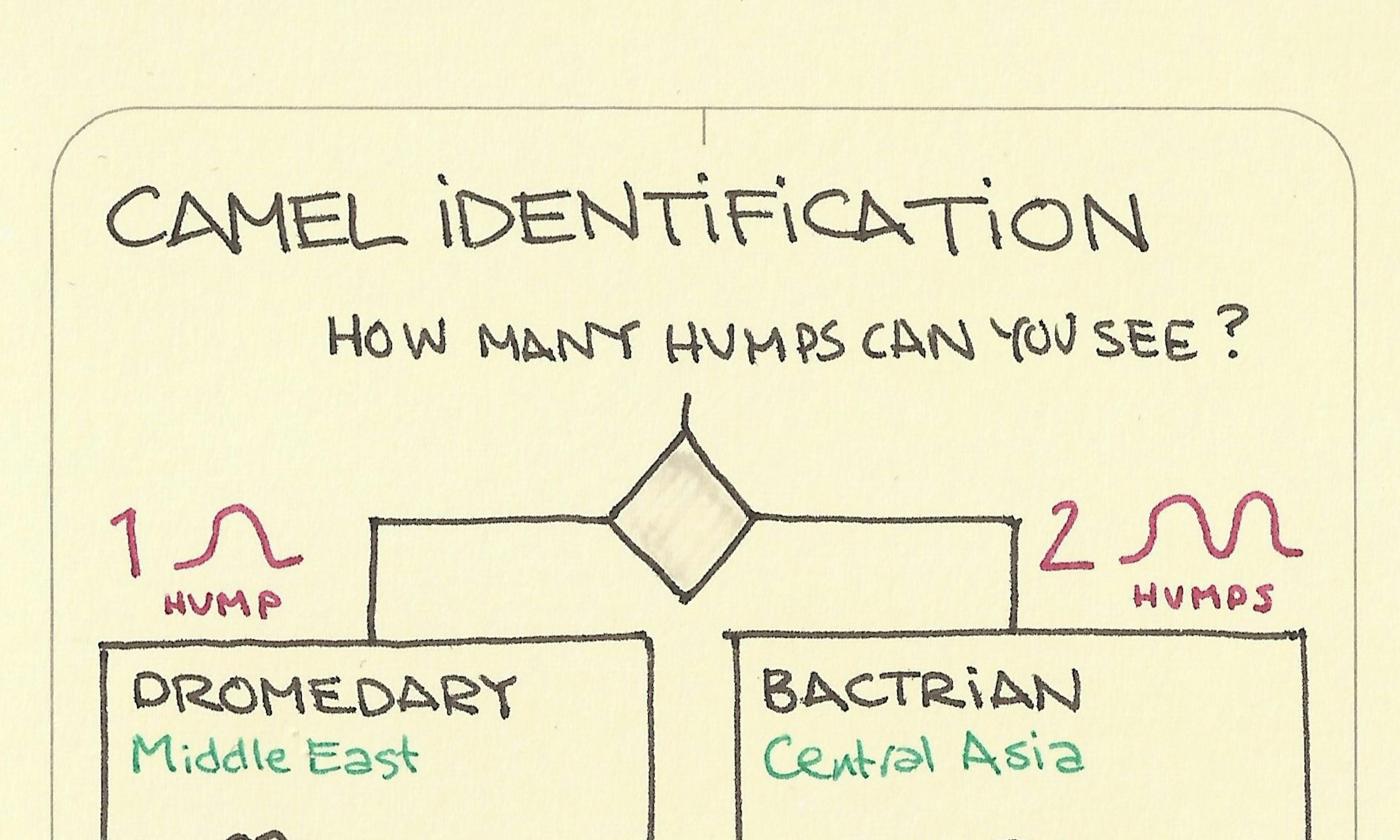 Camel identification: 1 hump dromedary, 2 humps bactrian
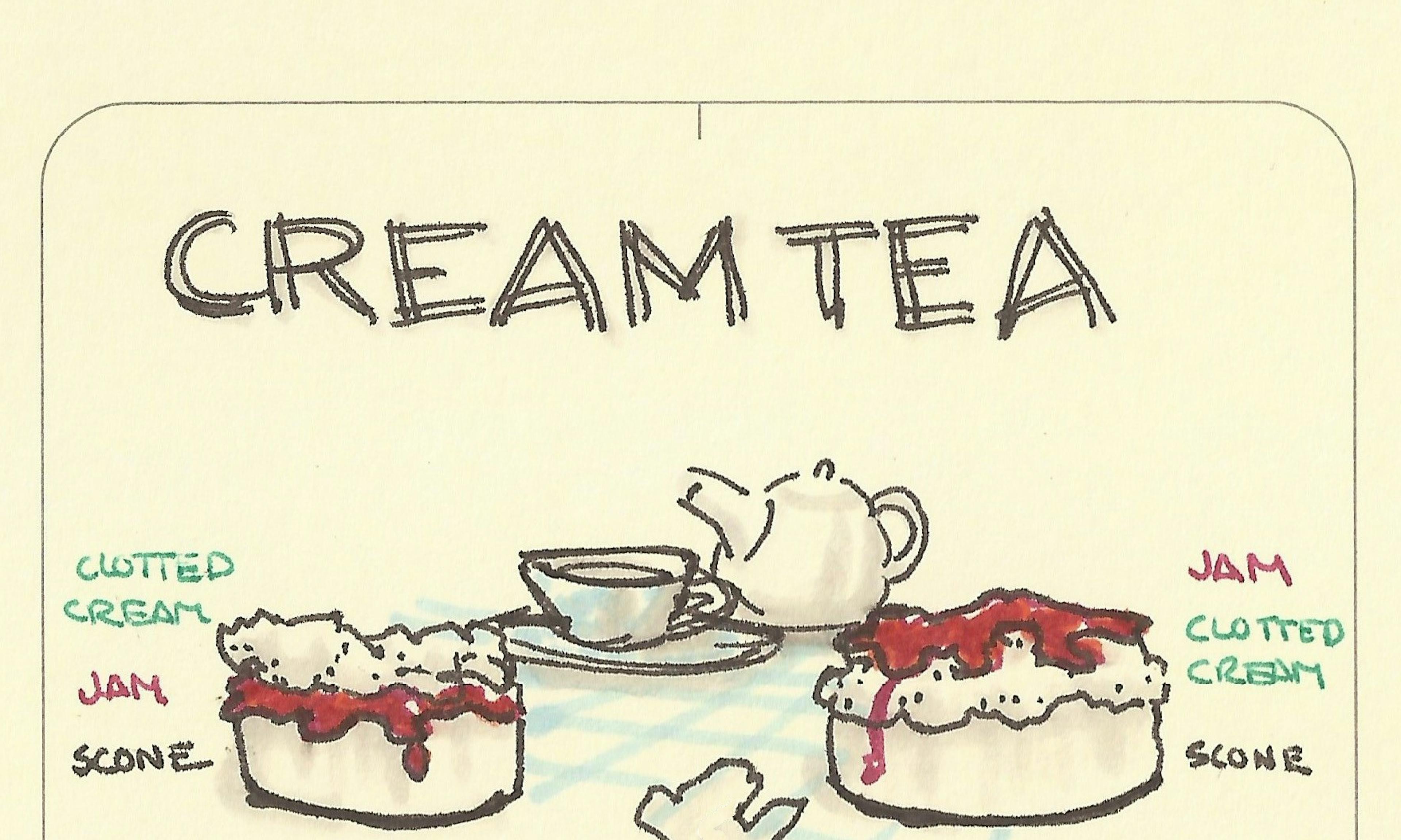 Cream tea: Cornwall vs Devon
 Tectonic plate interaction boundaries: Divergent, Convergent, and Transform
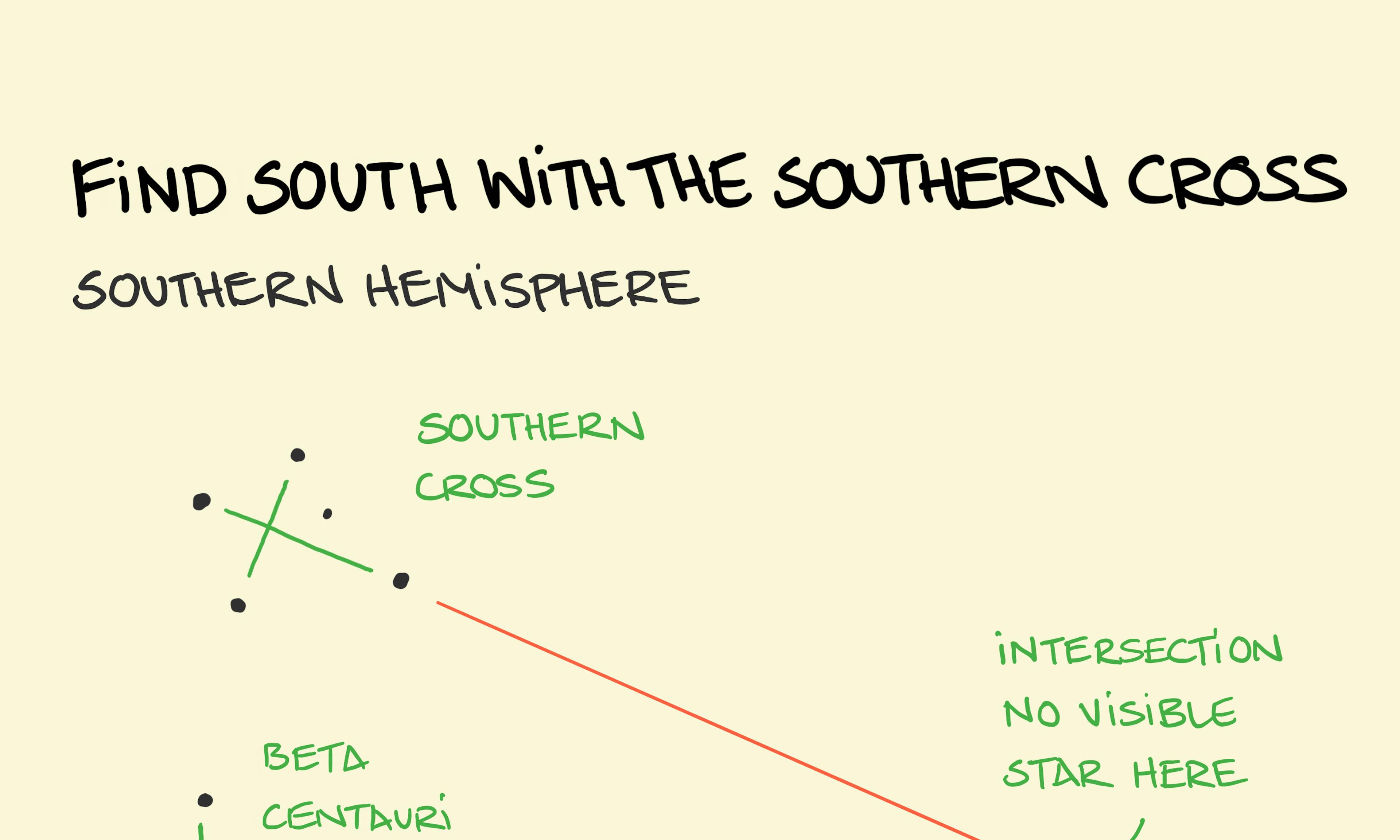 Use the Southern Cross to find South (Southern Hemisphere)
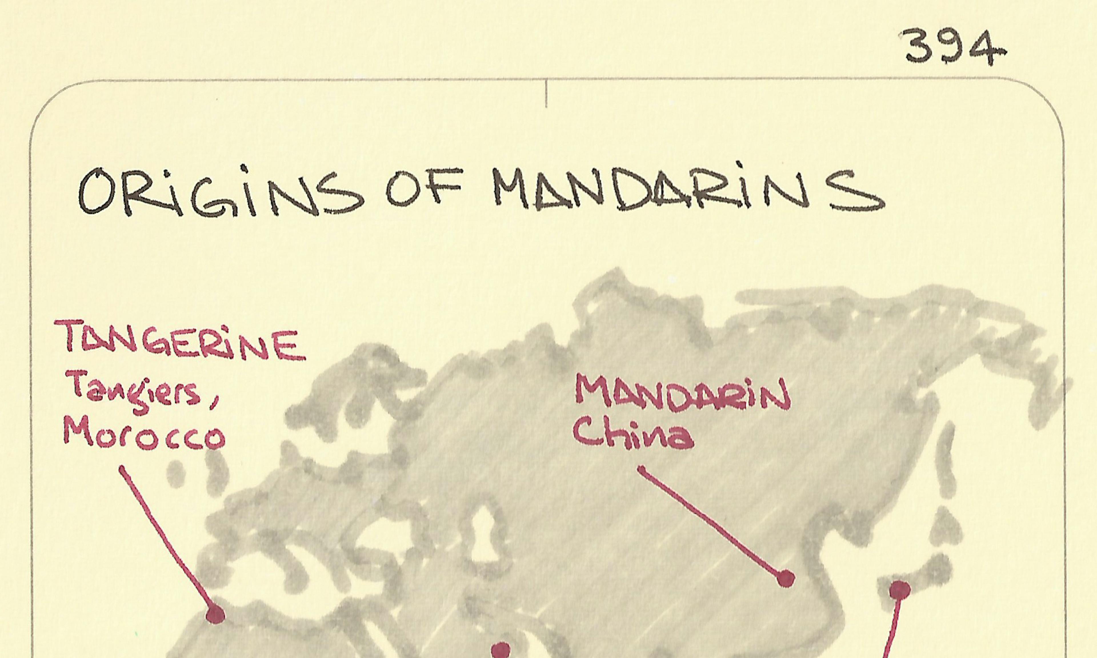 Origins of mandarins
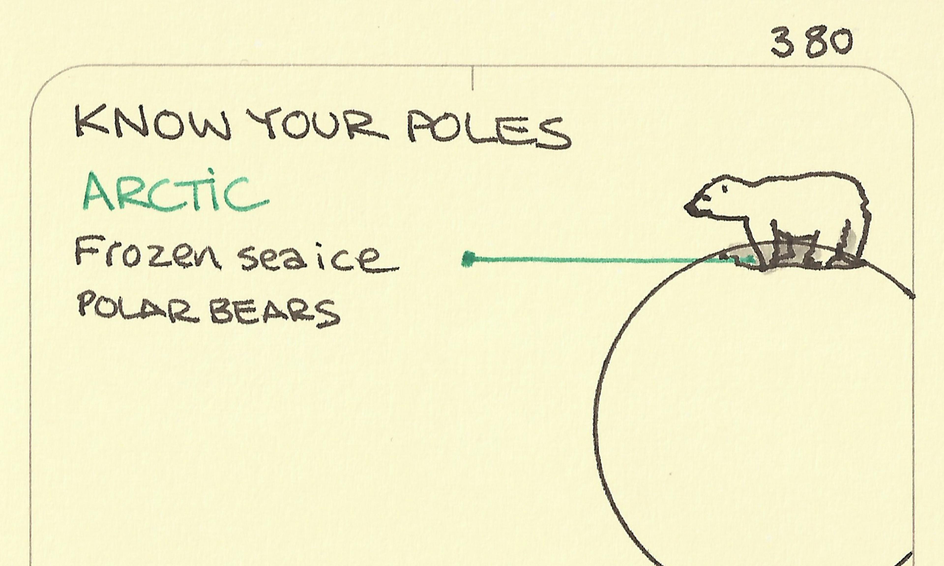 Know your poles
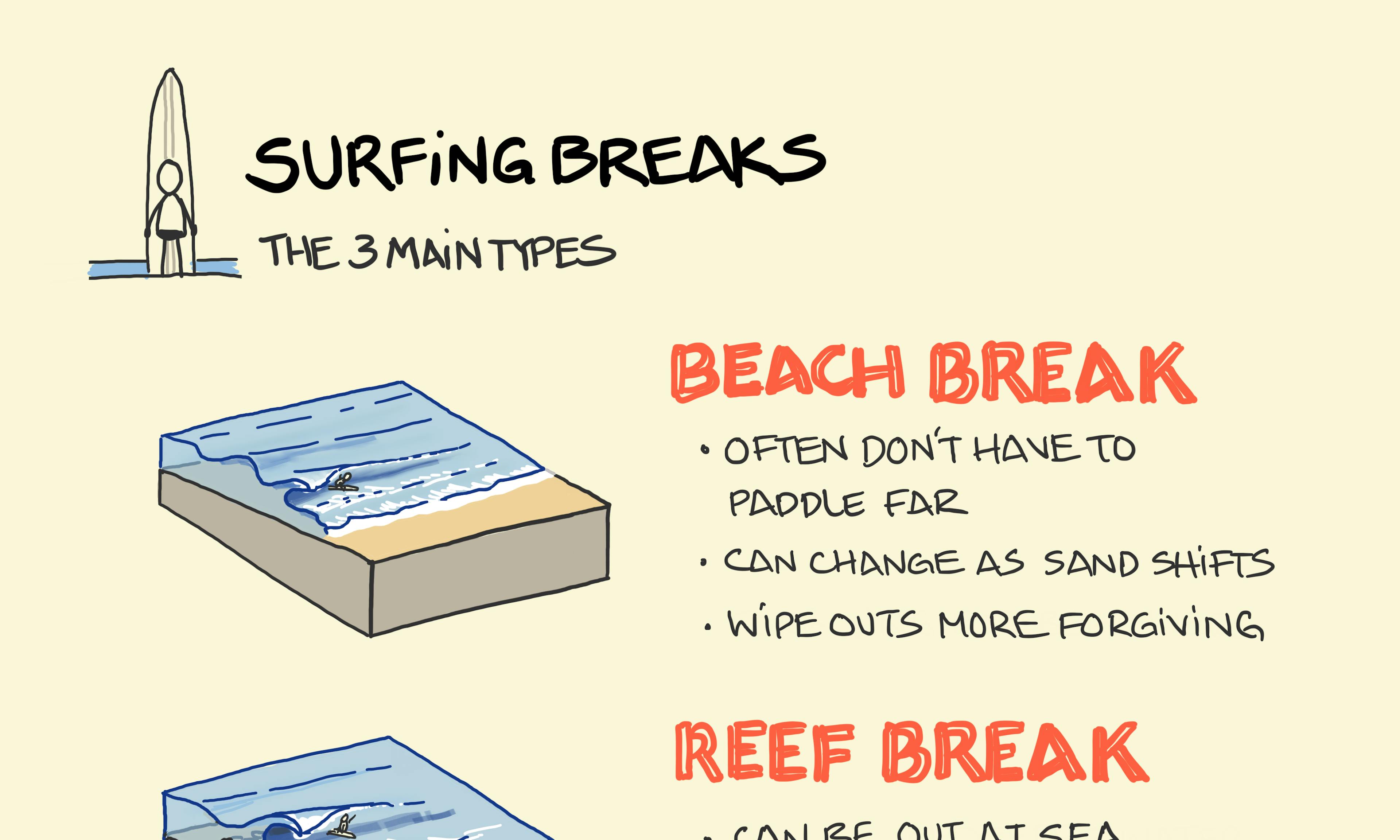 The 3 Main Types of Surf Breaks Explained
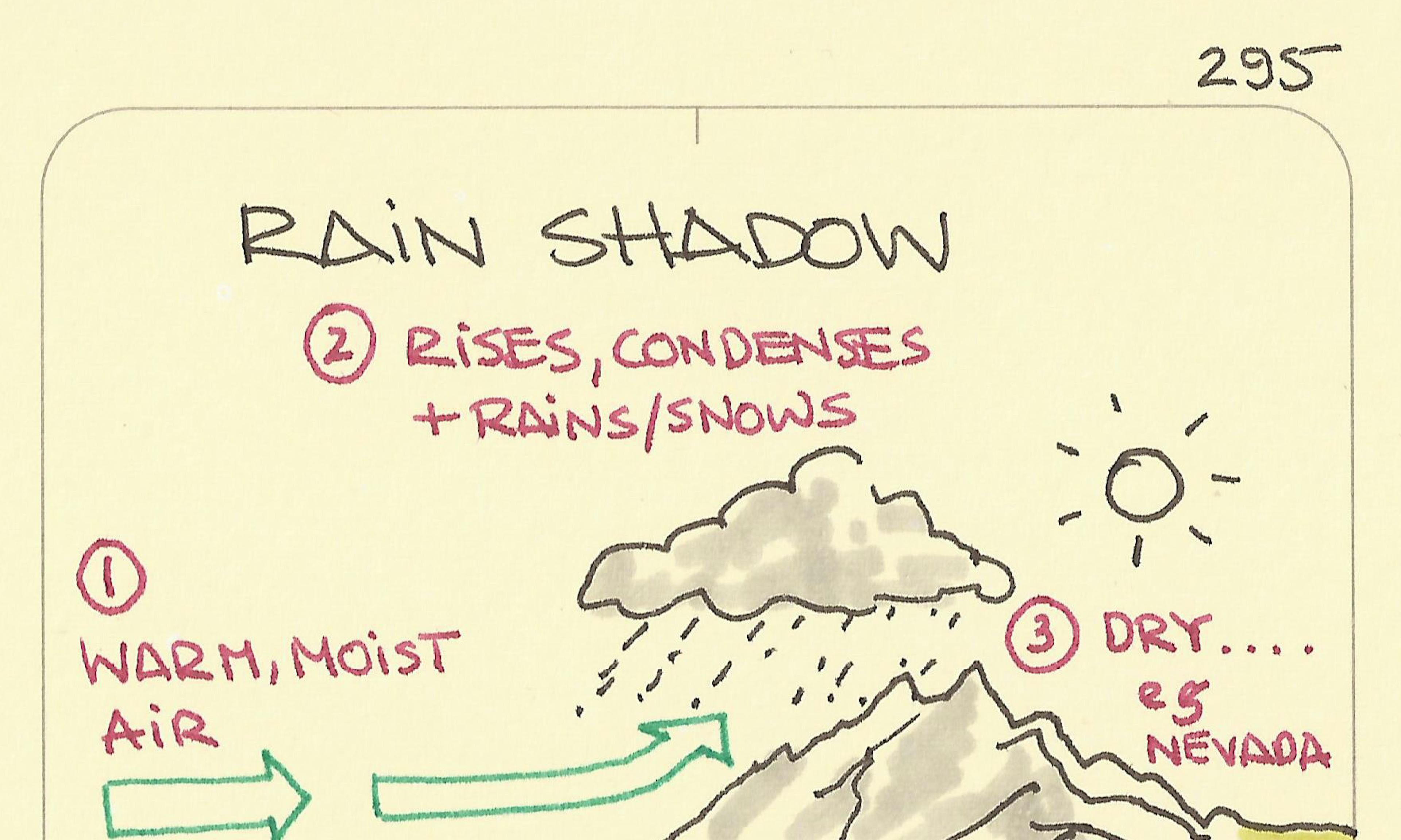 Rain shadow
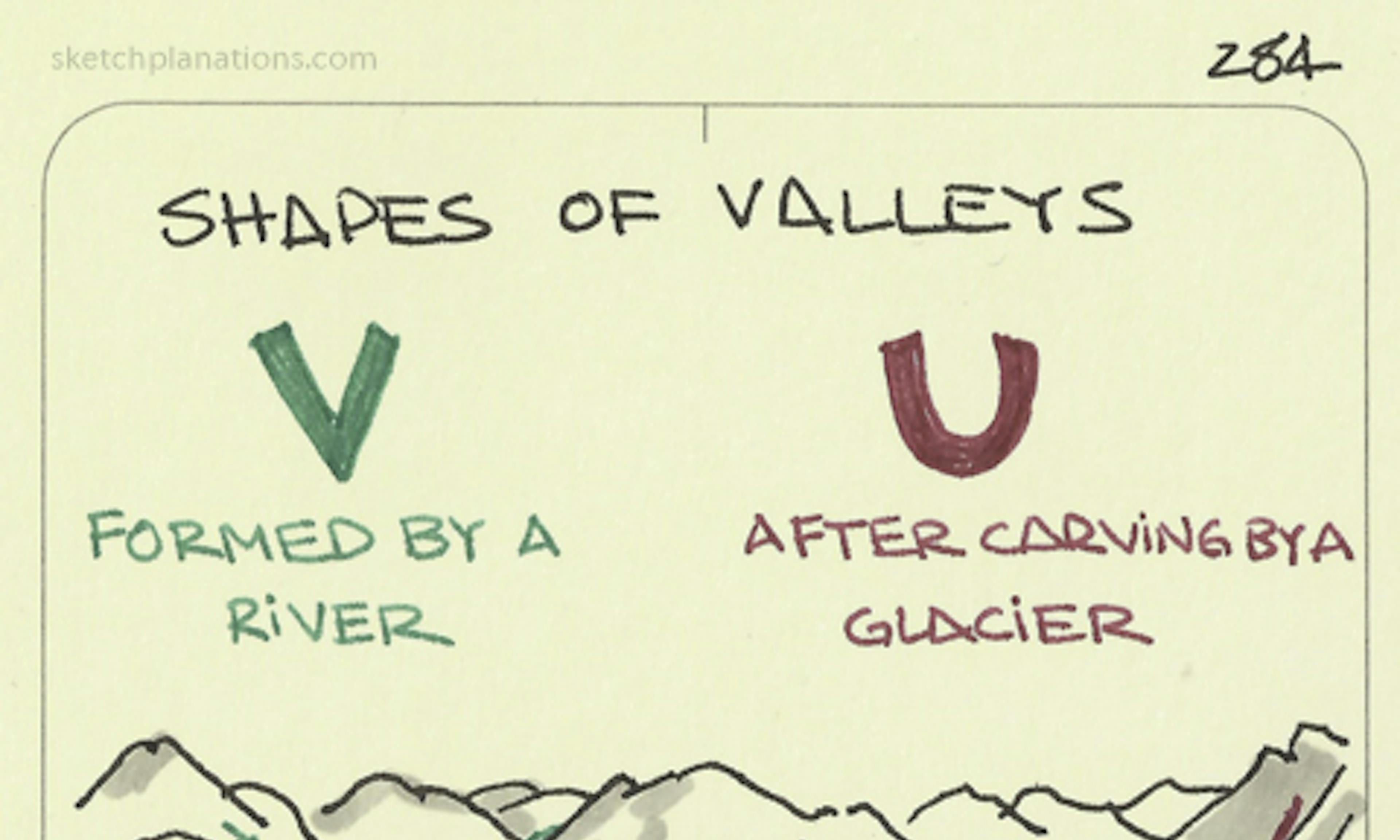 Shapes of Valleys
 The sun rises Early in the East
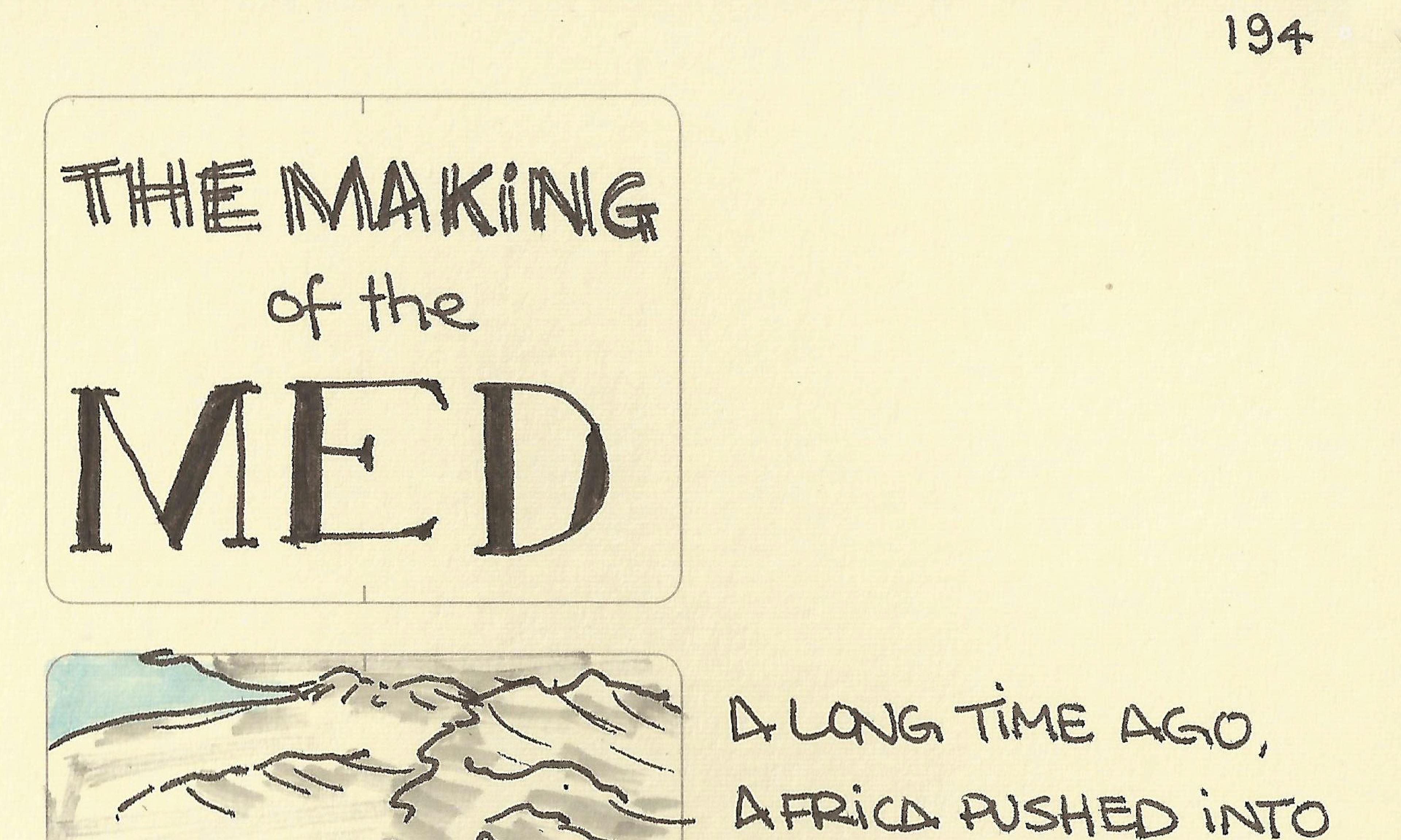 The making of the Med
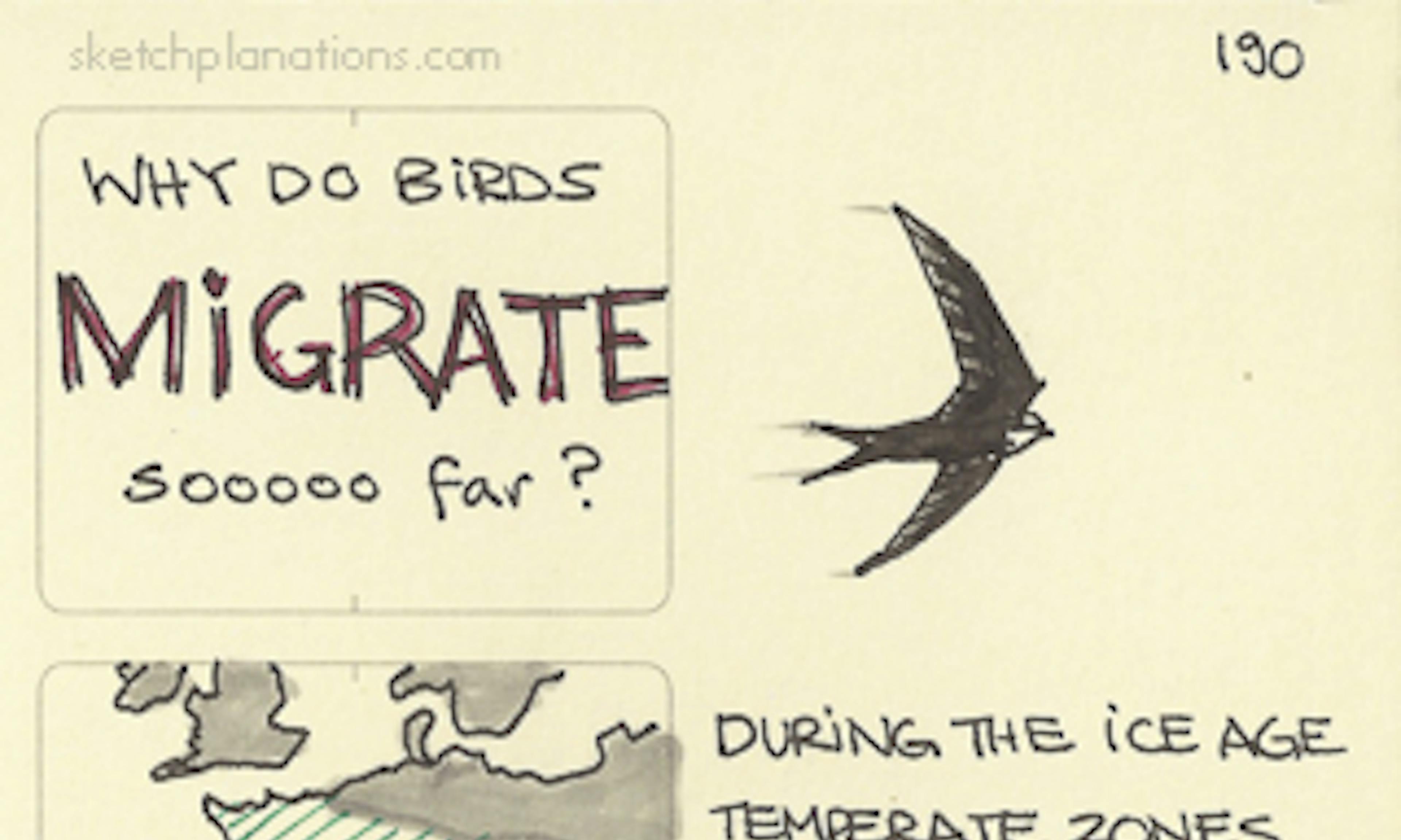 Why do birds migrate sooooo far?