

Topography and Bathymetry
👇 Get new sketches each week
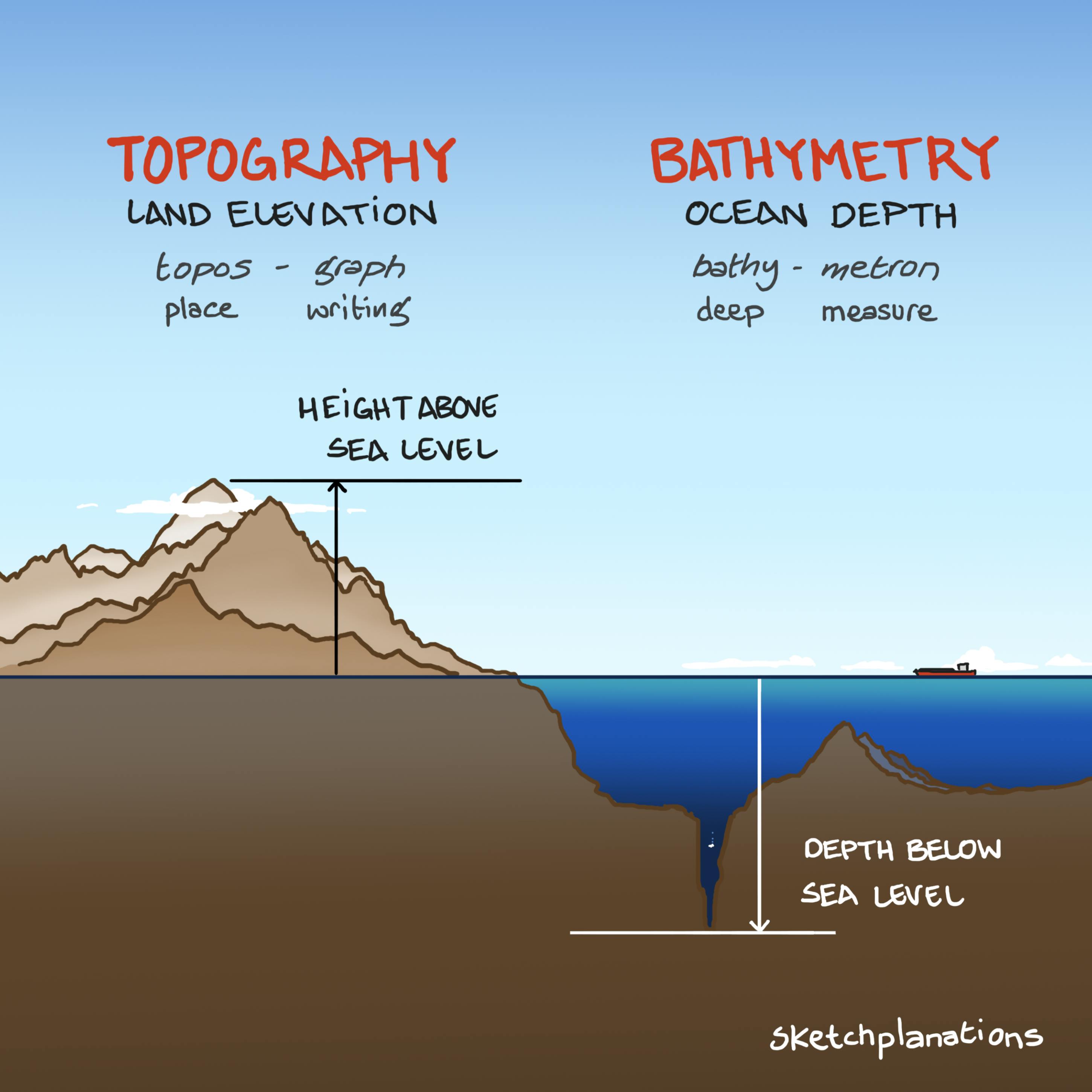
Most people are familiar with topography but lesser known is its underwater cousin, bathymetry.
What is Topography?
Topography is the study of land elevation, the ups and downs, forms and features, relief and terrain.
The word topography comes from the Greek topos, meaning place, and graphia, meaning writing.
In its original sense, similar to ethnography, which is writing about people, topography means writing about a place.
What is Bathymetry?
Bathymetry is like topography flipped upside down.
Bathymetry is the study of the ocean depths, underwater features and terrain. It's everything from the water's surface downwards rather than upwards.
The word bathymetry comes from the Greek bathy, meaning deep and metron, meaning measure.
In case you were wondering, the highest peak shown is Mount Everest, at 8,848 m above sea level, drawn to scale alongside the Mariana Trench, which plunges nearly 11,000 m below. Also visible: the typical depth of the Atlantic seafloor and the underwater peaks of the Mid-Atlantic Ridge.
Related Ideas to Topography Bathymetry
Also see:
- The 3 Tallest Mountains
- Tectonic Plate Interaction Boundaries
- Naismith's rule for mountain hiking time
- Point Nemo — the remotest place in the oceans
- The Coastline Paradox
