

Lake-effect snow
👇 Get new sketches each week
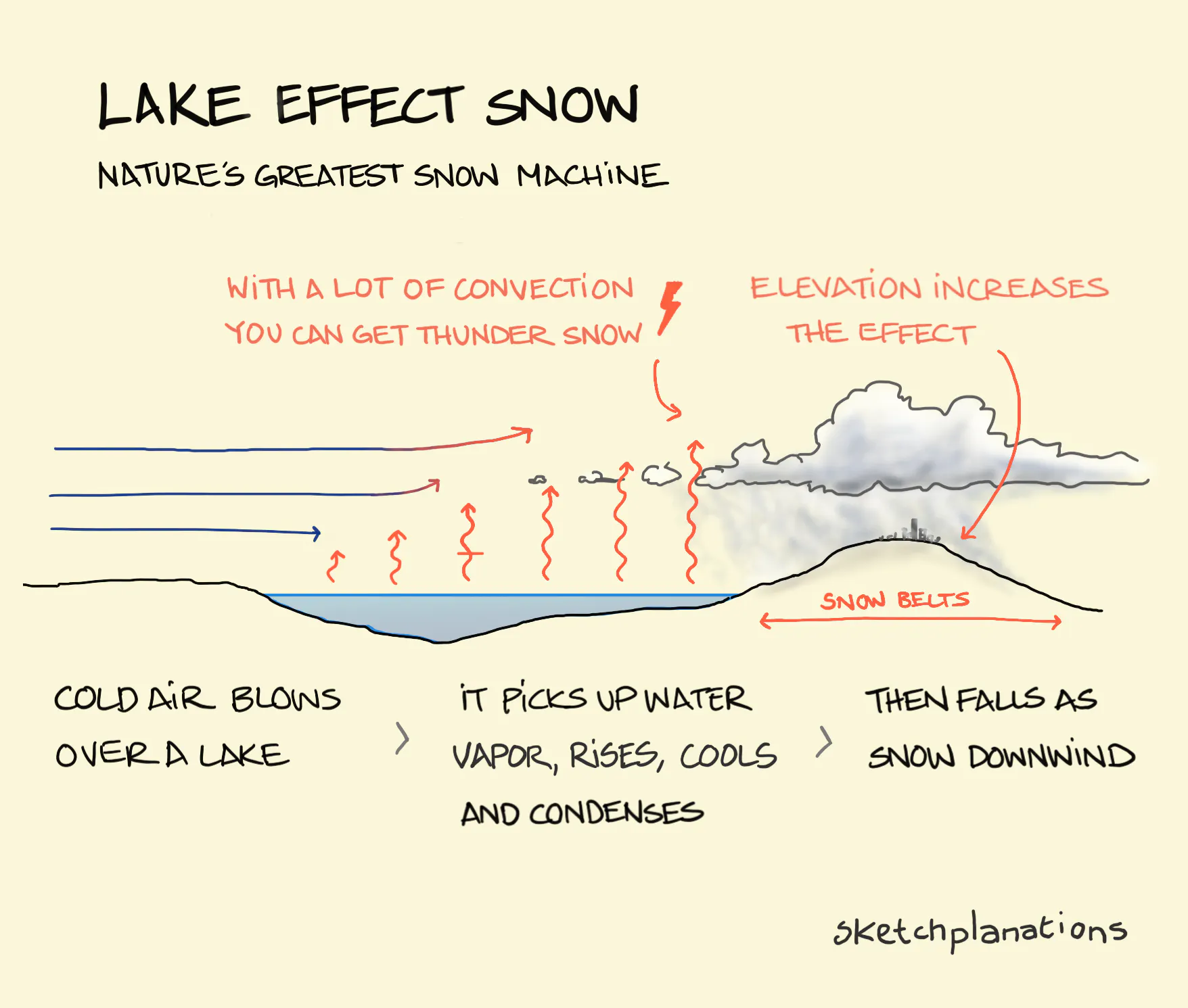
Lake Effect Snow is a phenomenon where crazy amounts of snow can fall in massive storms on a lake’s downwind—leeward—side. Where the effect is pronounced, to the east of some of the Great Lakes in the U.S. (think Buffalo), it’s responsible for the regions known as the snow belt.
It works like this: Cold air blows over a lake. As the cold air passes over the warmer lake, it picks up water vapor from the water, which warms the air. This causes the air to rise and, in turn, cool, such that when it reaches the downwind side of the lake, it has become cold and moist. This simple change can lead to some incredible snowstorms dumping 2 to 3 inches of snow per hour. Satellite pictures show it in action pretty clearly .
If there is a rise in land elevation along the path of the cold air, the air can cool faster and increase the effect — and also cause a rain shadow. And if there’s a lot of convection and the air rises quickly, you can even get what’s called thundersnow—a thunderstorm in a snowstorm.
Stay warm out there.
More Weather Sketches
Find the weather interesting? Me too. Also see:
- Dirty thunderstorms
- Thunderclouds
- Yesterday’s weather (applying weather forecasting to productivity forecasting)
- Rain shadow
- Lenticular clouds
- Know your cirrostratus from your altocumulus
- British weather
- Banner clouds
For everyday weather-related phenomena explained, see Dennis Mersereau’s The Skies Above: Storm Clouds, Blood Moons, and Other Everyday Phenomena, Mountaineers Books (2022). Dennis is also the source of the lovely phrase Nature’s greatest snow machine .
