Isochrones

- Copied!
👇 Get new sketches each week
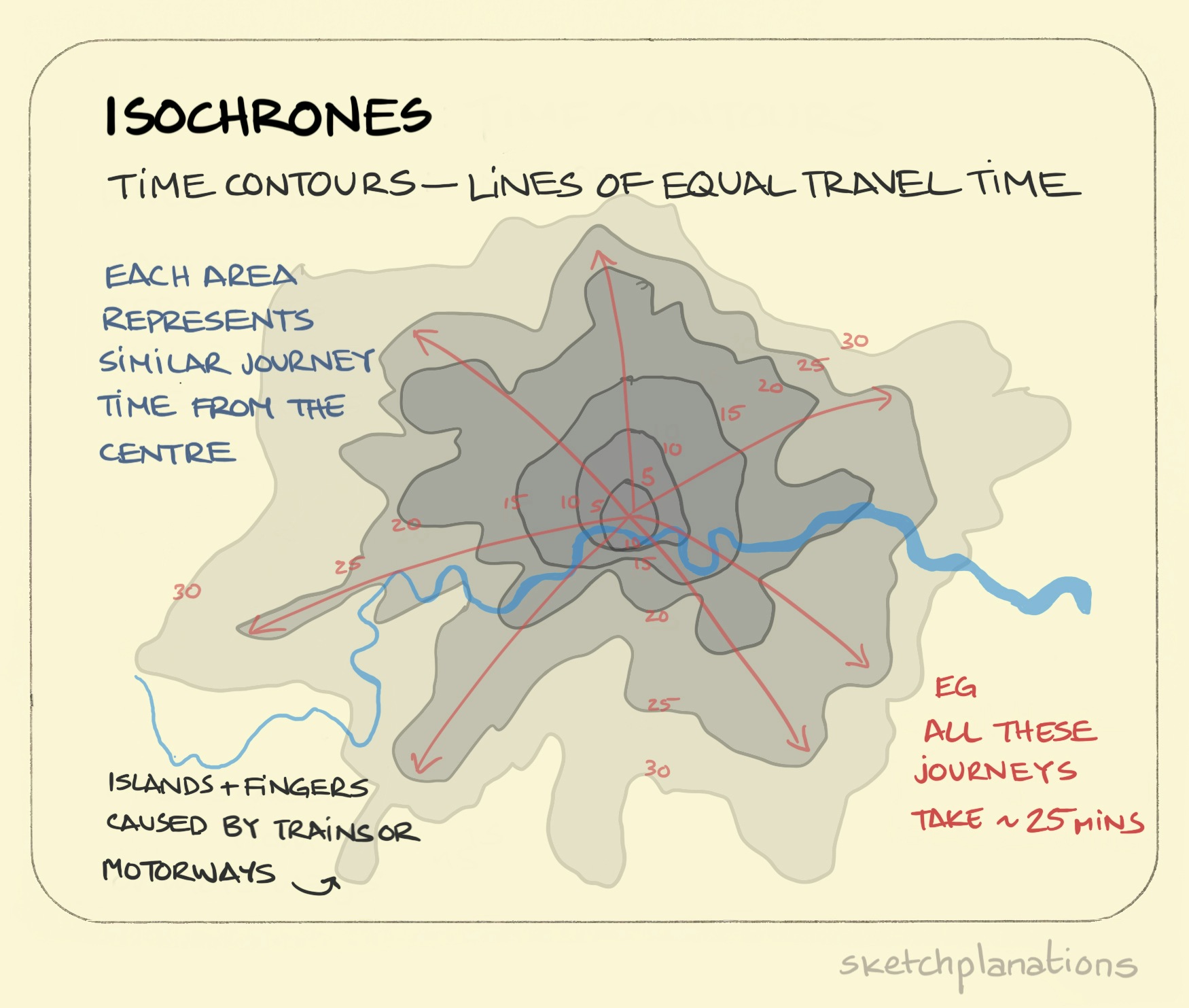
From the prefix iso meaning equal and khronos meaning time it literally means equal times. And whereas maps are usually put together with lines of equal distance you can either construct maps, or overlay maps as here, with lines of equal time. The overlay view gives you time contours rather than, say, altitude contours. Handy for checking things like commuting distance. I like how you find little islands where there is fast transport in and out like trains or planes.
You can explore time maps of London at mapumental .
Published

